Acadia National Acadia National Park has a little of everything. There are trees, a mountain, a sand beach, rocky shores, hiking trails, winding roads, and quiet coves. The top of Cadillac Mount is a place for the celebration of New Year’s Eve and seeing the sun rise first. The Park service requires reservations to go to the top of Cadillac Mountain and Sandy Beach. because of the reservation requirement for Cadillac Mountain finding a parking space is easier. Otherwise, a hike to the to the top of Cadillac Mountain is not for the casual hiker. Visit the website to review what is available and check the map to pick your spots or hiking trails. The park is an island. It is named as Mount Desert Island. The park is divided into two parts by a Sound. The portion with Bar Harbor has most of the attractions. This portion has Cadillac Mountain, Sand Beach, Abbe Museum, Nature Center, and Wild Gardens of Acadia. The other portion has less points which are not close together. The points of interest are Echo Lake Beach for swimming, Bass Harbor Head Lighthouse, and Pretty Marsh. Photographs are from both areas.
BEFORE OR AFTER A VISIT TO ACADIA NATIONAL PARK CONSIDER A STAY IN BUCKSPORT
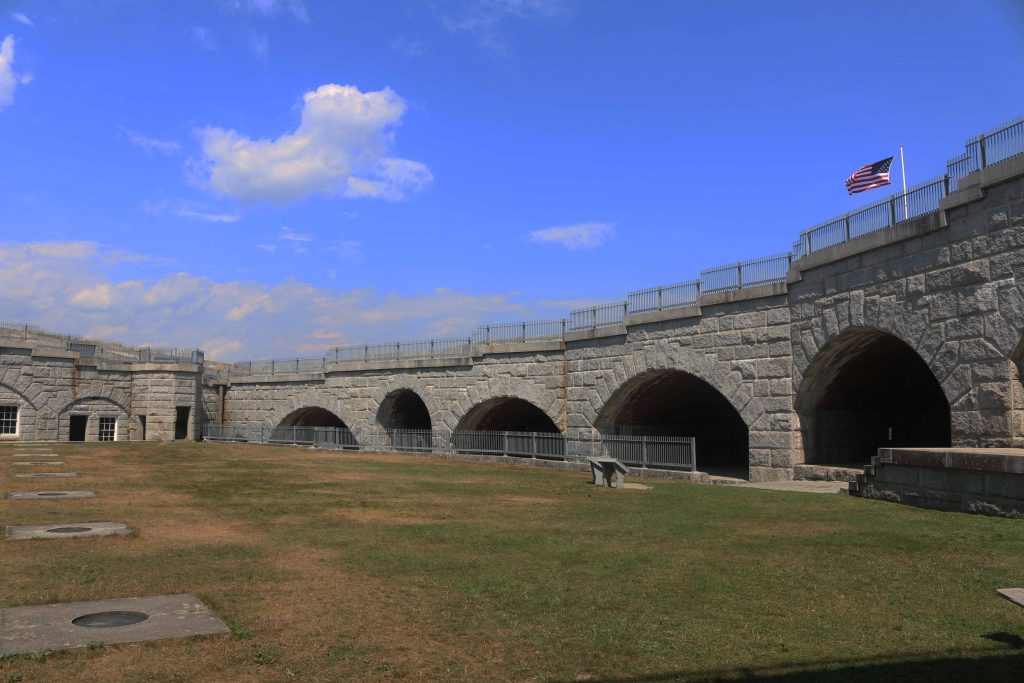
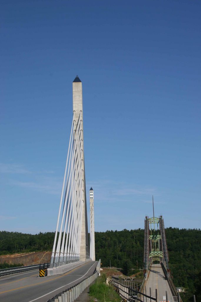
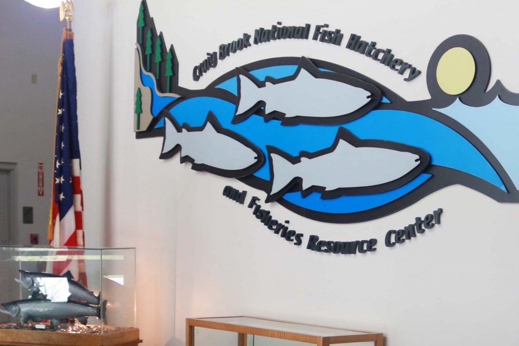
Near Acadia is the town of Bucksport. Besides the services normally found in a town there are attractions. One is the original Fort Knox. This fort was built during the Revolutionary War to protect against an invasion from the north. The fort never had to fire a shot to fight back an invasion. A new bridge was built to Bucksport. The old bridge has been removed and only the new bridge remains today. The new bridge has two columns to support the cables for the suspension cables. On the side of the bridge for crossing the river to get to Bucksport, the column has an elevator to the top so that you have a bird’s eye view of the area. If you have a desire for ice cream, consider a visit to the Diary Port at 79 Main Street in downtown Bucksport. If you are like a lobster roll, visit Crosby’s at 30 State Route 46, Bucksport. On the road to Acadia National Park, a side trip to Craig Brook Fish Hatchery, Craig Pond, and a hike up to the top of Craig Pond Mountain is a time away from the crowds. The following photographs will introduce you to these adventures.
FORT KNOX


The old and the new bridge over the Penobscot River.
The bridge crosses the western channel of the Penobscot River to Verona Island. Another bridge crosses the eastern channel to Bucksport.
The old bridge was removed. The pictures were taken just after the new bridge was completed.

Old bridge in front. The old bridge has been removed,


in background.
Shows that a visit to either the fort or bridge are close to walking distance.

CRAIG POND MOUNTAIN AND POND
A place off the beaten path is Craig Pond. A place to be on small lake to enjoy a picnic and a place to splash in the water. The pond is accessed by Hatchery Road on US 1 or Acadia Highway after departing Bucksport toward Acadia. As you would guess there is the Craig Brook National Fish Hatchery at the end of this road. The hatchery is on the shore of Alamoosook Lake. Before reaching the hatchery is the Craig Pond Access Road. When coming from US 1 it a right turn. Follow the road until the pond is reached. The hatchery visit can be short or long stay. Driving past the hatchery take the first road on the right to go the parking area to hike up Craig Pound Mountain. Pulling a trailer up and turning around would be more than challenging.
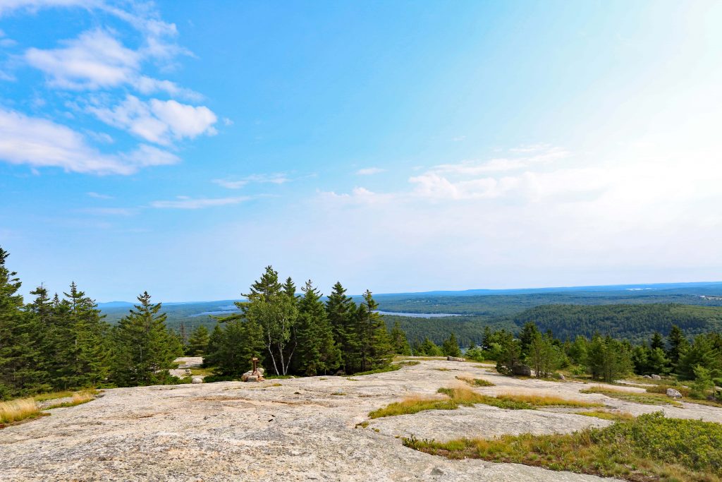
THE HIKE UP CRAIG POND MOUNTAIN
The trailhead is on your left as you drive in the small parking area. The hike up for the first third or so is a quick ascend. Each step is a step up over roots.


The vegetation has been worn off by foot traffic.


ACADIA NATIONAL PARK
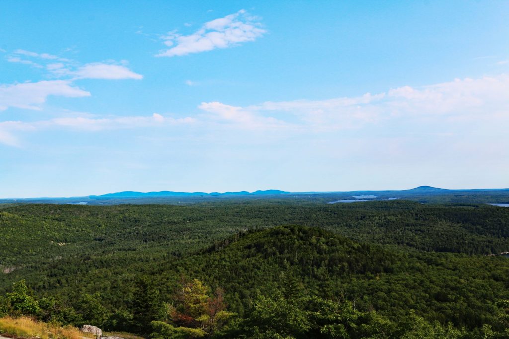
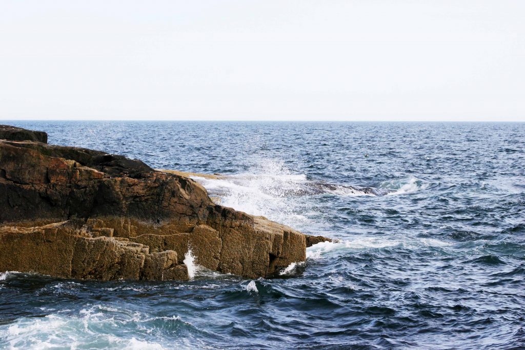
Continuing down Highway 1 to Ellsworth, you depart Highway 1 for Highway 3 to Trenton. After the bridge is crossed, the journey continues on Highway 3 on to Mt. Desert Island and Bar Harbor and Acadia National Park. Acadia National Park is popular. In 2021 access by motor vehicle was limited. A reservation had to be purchased. This made a difference since parking was available. Parking along the 27-mile-long Park Loop Road that is one-way out of Bar Harbor is quickly taken. When you enter through the Cadillac Mountain Entrance, you have a choice to go straight to the top of the Cadillac Mountain or enter the Park Loop Road. Getting to the top of Cadillac Mountain for sunrise also required a reservation. To get away from the crowds, Schoodic Point is place to sit and watch the waves crash against the rocks.
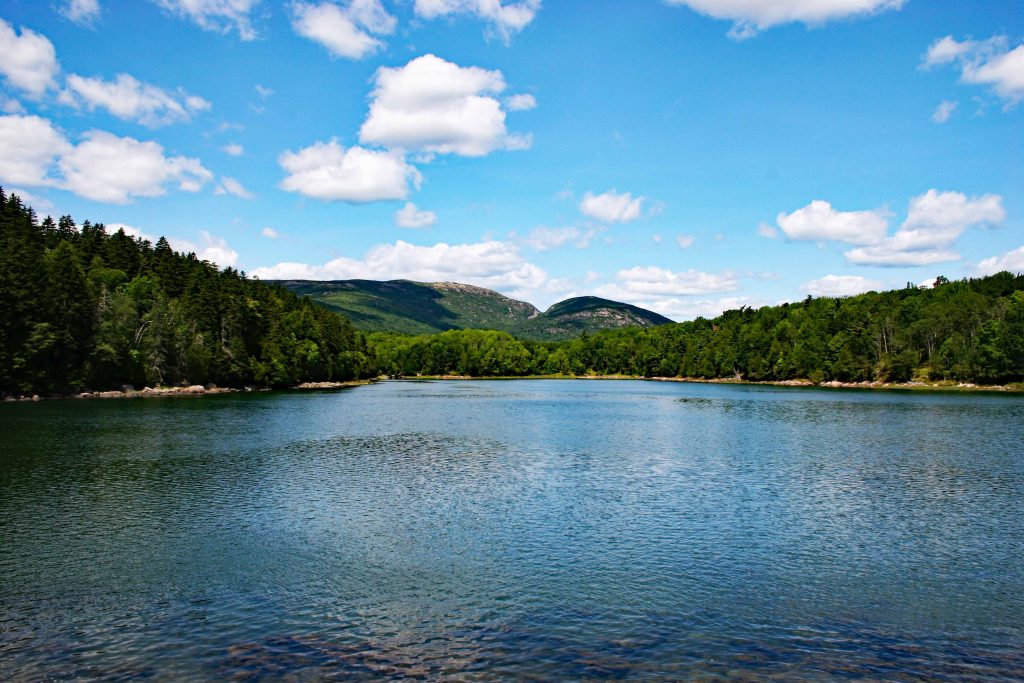
The road to the top of the Cadillac Mountain has an overlook of Eagle Lake. If traffic permits, a stop and a short walk allows this view of the lake.

A south view over Eagle Lake. (2021)

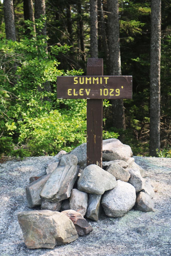
The visit to Acadia National Park had new procedures to access the top of Cadillac Mountain and Sand Beach. A Golden Eagle Pass or entrance fee was need along with a reservation to drive to the top of Cadillac Mountain. There was an advantage for having a reservation. There was parking available at the top. On arrival at the top in less than 100 feet there was a parking space. The following pictures were taken from the top or from the trail to the top.

The top of the mountain is to the right. (2021)

Taken in 2016.


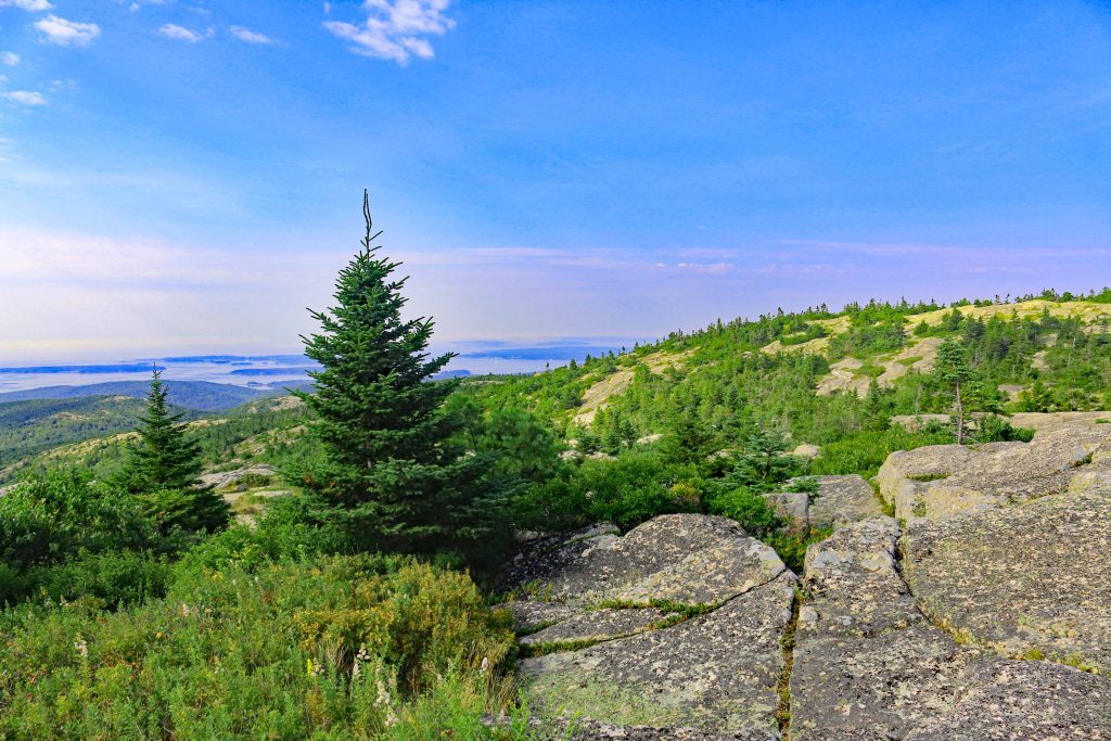
A magnified view of a bay on the ocean side of the mountain. (2021)
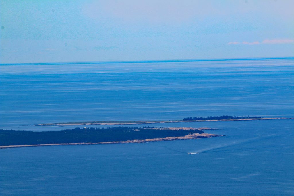
Looking out into the ocean. (2021)

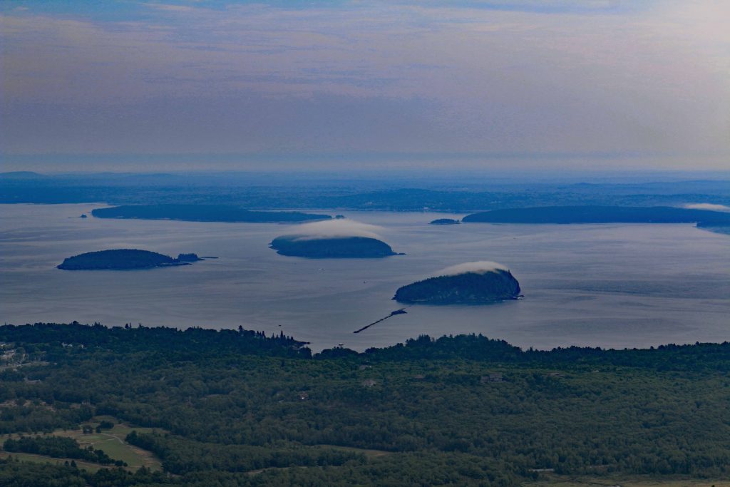
Looking out into the bay with Bar Harbor in the foreground. No fog on the islands. (2021)

A closer look at Bar Harbor. (2021)

VIEWS OF OTHER AREAS OF ACADIA NATIONAL PARK.


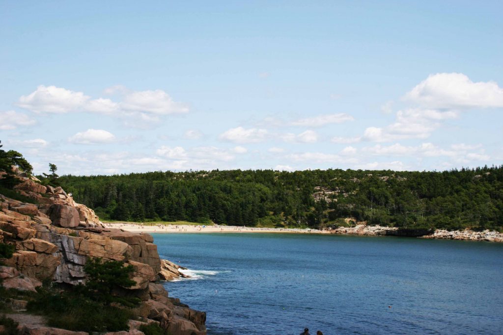

The beach at sunset is empty since the sun going down is in the opposite direction of this view. (2021)

This looking to the other side of the beach. (2021)

The beach visitors at sunset. (2021)
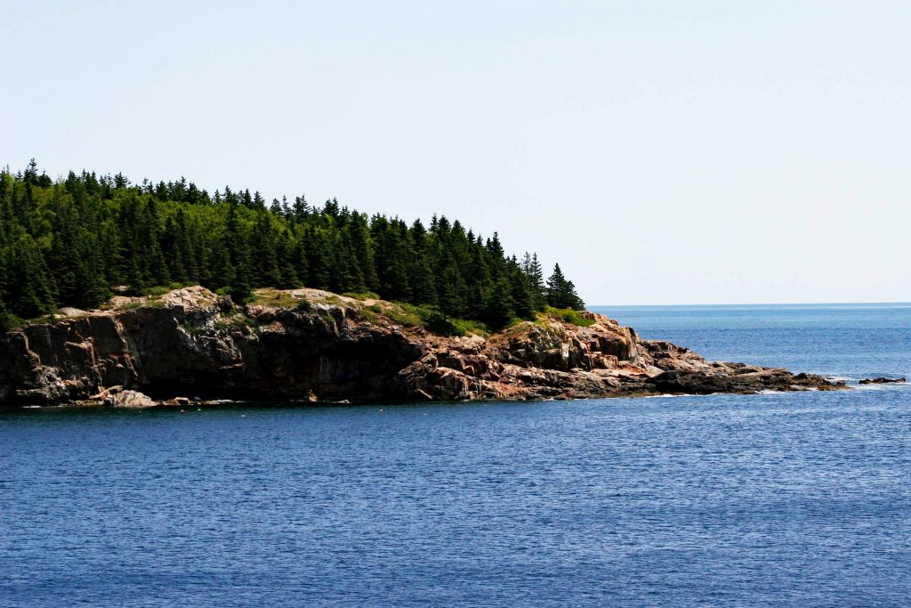
The point on the left side during the day. (2016)
PICTURES TAKEN ON A DRIVE THROUGH THE PARK.

Views from Schoodic Point.


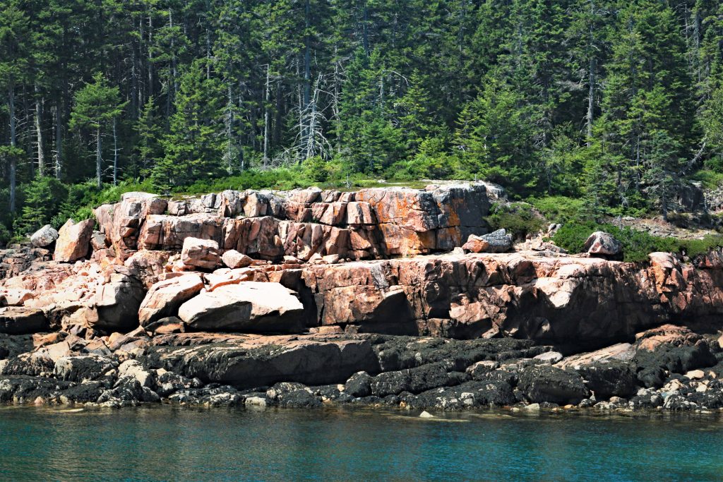
South of the Park.


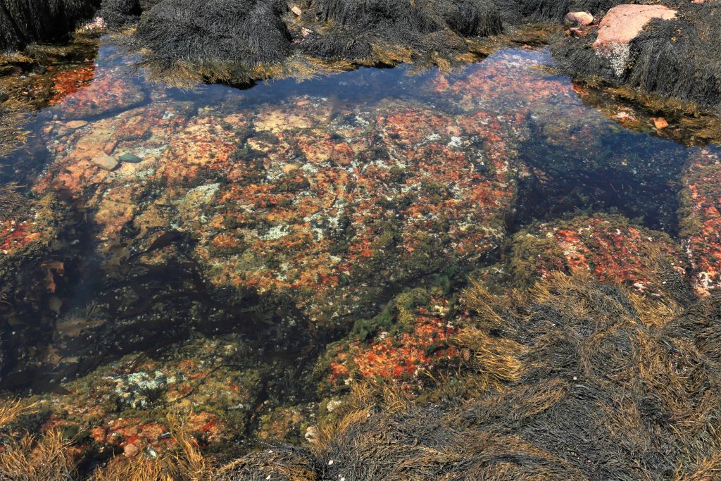
South part of Acadia National Park.

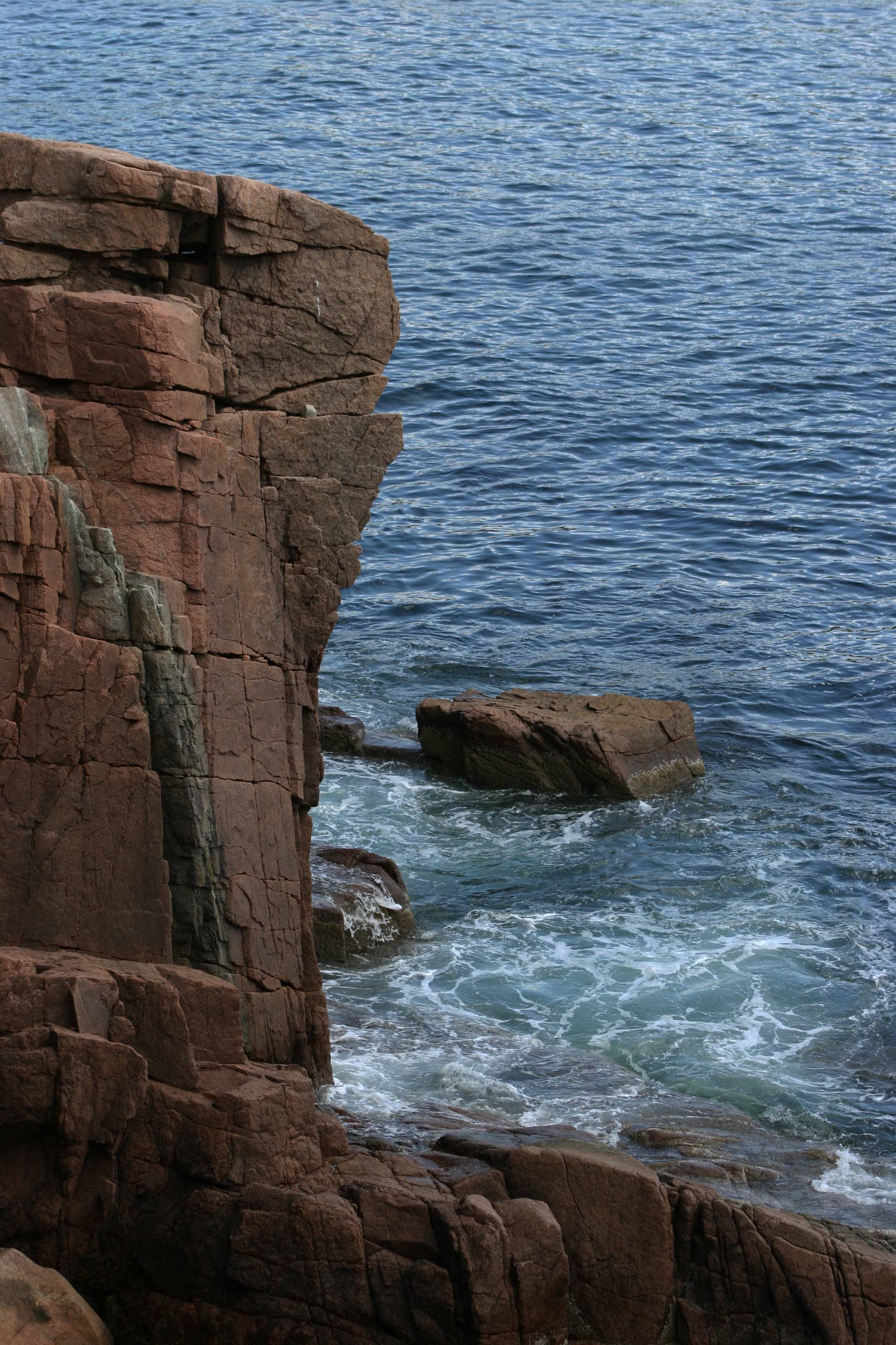
The south part is less developed. This is a view in the south part at low tide.


Bernard, Maine


