
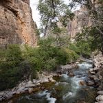
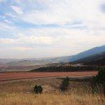
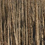
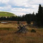
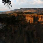
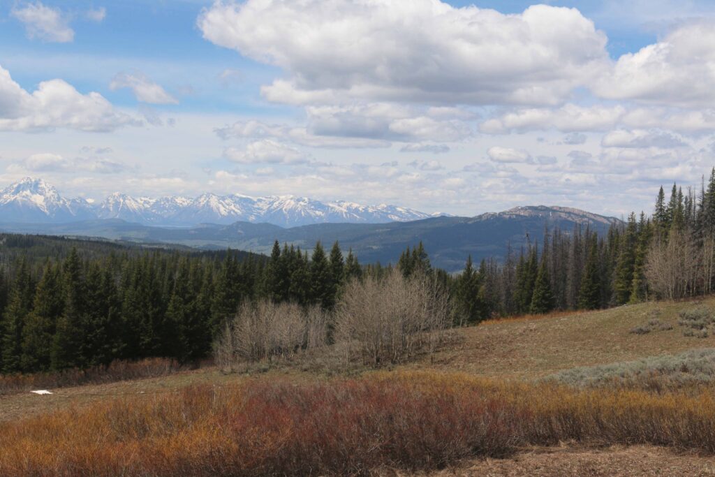
YELLOWSTONE NATIONAL PARK GALLERY
Yellowstone National Park has many wonders that are easily accessible. The following pictures are a preview. After this preview, the major areas are shown in larger pictures with explanations.


YELLOWSTONE NATIONAL PARK
Yellowstone National Park has many wonders that are easily accessible. Exploring the park takes days rather than hours in the summertime. Besides the traffic, there are animals on or near the roads. Animals stop traffic. Do not expect to drive 30 miles in less than an hour. The map of the park should be reviewed at the website so that you can plan your travels. Note sites as Old Faithful are crowded before the eruption. Best to arrive in the parking lots for Old Faithful not too long after the eruption to find a parking space. Even places to park at the swimming hole is limited. The parking lot to hike up Mt. Washburn is smaller than the parking lot for the bicycle path to the top of Mt. Washburn. This parking lot is a good place to watch a sunset. The parking lot for the hiking trail up Mt. Washburn does not accommodate large vehicles or vehicles with trailers. Areas as the Grand Canyon of Yellowstone attracts many visitors and challenges one to find a place to park. You can park in the Visitor Center for the Canyon Area parking lot and hike or ride a bicycle to this area. Be prepared to give a lot of time for your travels. It is worth the time to explore this park.
There are five entrances to Yellowstone National Park. If you visit Cody, Wyoming to visit the Buffalo Bill Center of the West, you will be entering by the east entrance. Route 14 takes you to the east entrance. Coming in this way, you could encounter a park resident. There is also a northeast entrance. This is through the Bear Tooth Mountains. This is also accessible from Cody by traveling north. This entrance uses the Bear Tooth Highway. Motorcyclists have this on their bucket list to ride. The south entrance as two ways to reach the south entrance. The north entrance is the oldest. The remaining entrance is the west entrance.
Which entrance should you use?
Will you be coming from Montana? Utah, Colorado, Idaho, and South Dakota?
Coming from South Dakota I-90 westbound would be used. Coming from Nebraska westbound I-80 would be used. From Utah eastbound I-80 is available. From
Colorado northbound I-25 would be used.
The next decision is which park entrance should be selected. Why would you use one entrance versus another.
Choice One.
Which entrance has available lodging or campsites? As is becoming true at national parks, reservations are made almost a year ahead for lodging or campsites. What choices are available.?
Choice Two.
What do you want to see first? Yellowstone? Cody, WY? The Tetons? The first entrance to Yellowstone? The Wind River Basin? Do you want to leave the same
way you came?
EAST ENTRANCE (Cody)
One choice is the east entrance that has Cody, WY as the gateway. Cody has lots of activities. Visit the website for what Cody has to offer. Red Gulch Dinosaur Tracksite is a short detour off Route 14 on your way to Cody. It is 73 miles east of Ranchester and 69 miles east of Cody.
From South Dakota, I-90 is continued west to Ranchester.
Ranchester is reached from Nebraska by exiting I-80 at Cheyenne, WY to go north on I-25 and continue north on I-90 to Ranchester.
From Colorado journey north on I-25 to merge into I-90 to Ranchester.
From Idaho and Utah, I-80 eastbound to Cheyenne, WY by exiting I-80 at Cheyenne, WY to go north on I-25 and continue north on I-90 to Ranchester.
At Ranchester, WY is the exit off I-90 to Route 14. Route 14, 16, & 20 is a choice as a road off the interstate to travel to Cody, WY and continue on to Yellowstone. Other choices are available. Buffalo Bill State Park is west of Cody. Has RV and tent camping.

From this picture there were open campsites at North Fork Campground in Buffalo Bill State Park ten miles west of Cody.
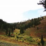
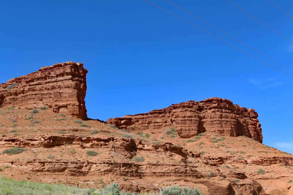
Some views as you travel west on Route 14, 16, and 20 from Cody, Wyoming.


A view of the depth of the canyons.

A view to show the height of the paas.


Looking back to the east. A small and quiet lake along the road from Cody on the left.


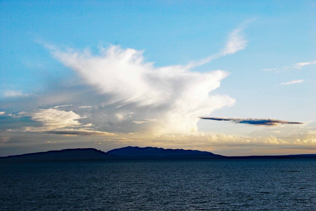
Yellowstone Lake
Note the white cloud is a collapsing thunderstorm and the cloud building behind it. The resulting storm included lightning and hail.
SOUTH ENTRANCE
THROUGH JACKSON ON ROUTE 191 OR ROUTE 287 FROM RAWLINS TO ROUTE 26 TO ROUTE 191.
One choice is driving up ‘route 287 from Rawlings. This route does not end at Jackson. Jackson is a large town with many lodging choices, a major food store, golf courses, wireless stores, shops, breweries. restaurants, and a town’s square. The drive-up Route 287 goes through smaller towns that do not offer as much as Jackson. The drive through the Wind River Basin is scenic. Long stretches between the towns after Rawlins. Fuel should be purchased in Rawlins. There is decision to made when reaching Lander, WY. Should a right turn be made onto 789 to travel 80 miles to the Wyoming Dinosaur Center in Thermopolis, WY. Check the website. In this region around Yellowstone National Park are some very old rocks.
ROUTE 287 FROM RAWLINS TO ROUTE 26 TO ROUTE 191.
The following photographs were taken along this road to Dubois.

 You can see for miles.


The landscape changes as the drive to the Continental Divide is being approached,

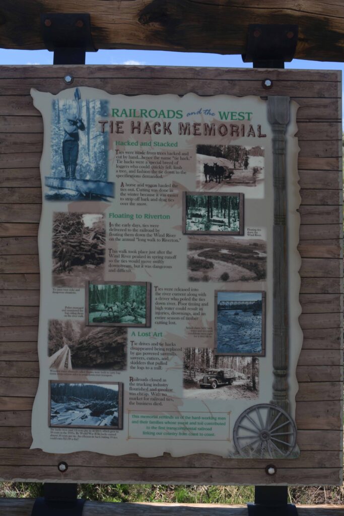
A roadside marker mentions a monument on a hill above the road. The top offers a view of what is coming.

The Hack Memorial

The monument is above the sign on the upper right.


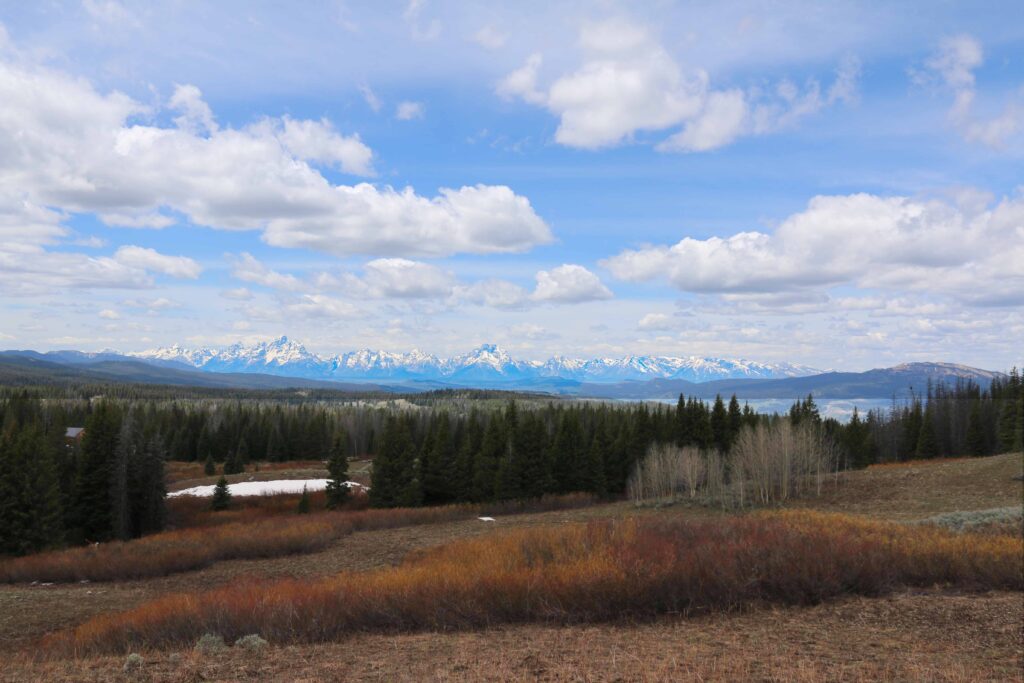
TOGWOTEE PASS

Then comes the mountain pass to view Jackson Hole from the east at almost 10,000 feet.


The above and following pictures were taken during the first week of June 0f 2022 at the crest of Togwotee Pass.
Through Jackson, Wyoming.
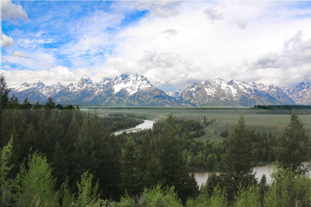
Would you prefer to visit the Tetons before your visit to Yellowstone? A minimum of two days would give you an opportunity to see the sights and have time to hike and have picnics in the Tetons. One choice is Colter Bay. This is close to the south entrance to Yellowstone National Park. You can elect to stay in the Tetons or go into Yellowstone.
Since I have not traveled far enough west on I-80 to go north on Route 191 at Rock Springs, WY, there are no photographs of this journey. The pictured start in Jackson, WY.


As you leave town on Route 191, your next stop to take pictures is Teton National Park.
GRAND TETON NATIONAL PARK
The following photographs were taken in the summer of 1996.


 An overcast dawn.
The following pictures were taken in the first half of June, 1922.
The Ansel Adams overlook.
These pictures were taken at Colter Bay from the shore of Jackson Lake.
Note how much of the shoreline is exposed.
T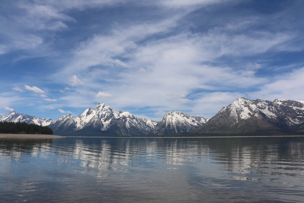


This picture illustrates how glaciers carved the mountains.

This was taken on an early morning hike at Colter Bay. Note how large the shore even though large amounts of water were flowing into Jackson Lake
by the Snake River.
JENNY LAKE
Jenny Lake is much smaller than Jackson Lake, There are hiking paths around Jenny Lake. There are boats that cross the lake from
the east to the west. It is worth the trip to hike up the mountain to Inspiration Point and see the Hidden Falls. At the end of the day there
can be a long wait to catch a boat back. The hike back is mostly level.
At Jenny Lake there is a shuttle boat that crosses the lake to the base of the Grand Tetons.
Or you can hike 2.4 miles to reach were the boat docks to walk to Hidden Falls and Inspiration Point.
The shuttle runs frequently. There is a caveat. Do not plan on a quick trip back at the end of the day.
The wait time may be hours.
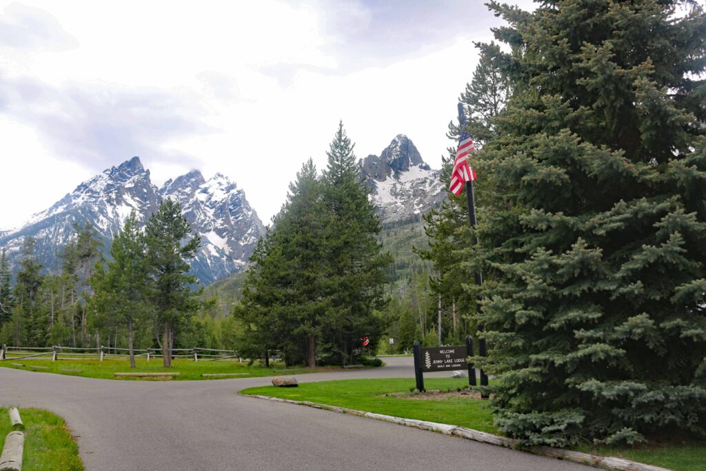
The entrance to Jenny Lake Lodge.

Hidden Falls.
.
The view from Inspiration Point toward the northeast.
p h
h
This is a morning picture taken when leaving Tetons National Park when driving to Dubois to journey through the Wind River Basi.
View from Jackson Lodge.

There is a walking path behind Jackson Lodge. A large open space exists.
Look for animals when driving or hiking.
Animals can be found if you look closely. This moose was barely visible from the road.
The camera lens brough it closer.

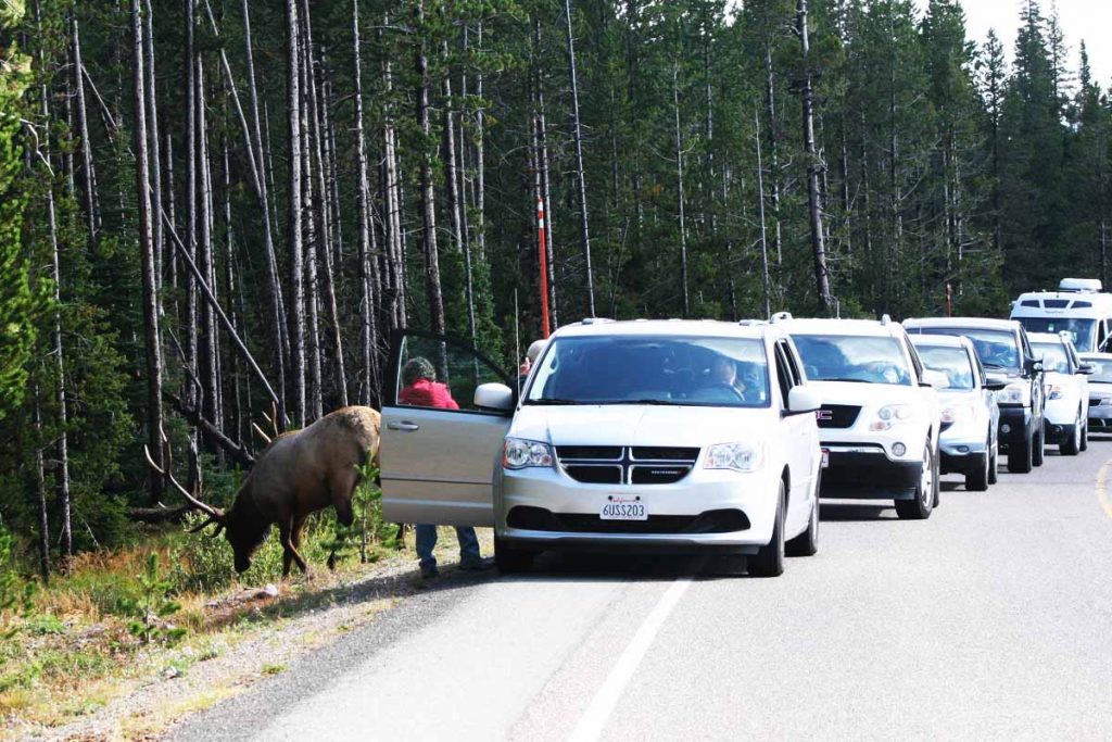
In some circumstances the animal is almost in the road as this elk was.

YELLOWSTONE NATIONAL PARK FROM THE SOUTH ENTRANCE.

Yellowstone Lake is on the other side of the road,
 This was the elk before the road was crossed to stop traffic.
The west entrance is through West Yellowstone, Montana on Route 20. The population is about 1,400 in 2018. This entrance is closer to Old Faithful and the Geyser Basin.
THE NORTHEAST ENTRANCE
The Northeast Entrance is accessible from Cody, Wyoming by driving up Route 120 to Route 296 that intersects Route 212 coming from Red Lodge, Montana. Route 212 continues on to Cooke City, Montana pass Pilot Peak (11,708 feet).
The following photographs are just outside of Cooke City.


Shows a different perspective from the same view point.

The clouds have cleared more.
Cooke City, Montana.


ANOTHER ENTRANCE IS THE NORTH.
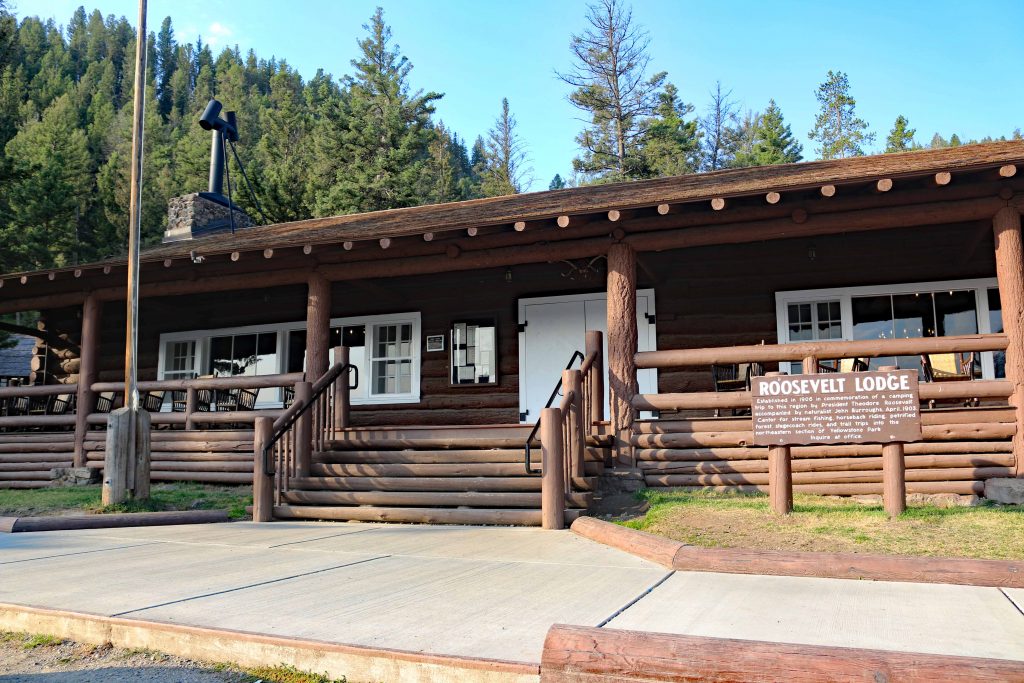
Since the Roosevelt Lodge is near the north entrance, there is much more development. The town of Gardiner, Montana is reached by Route 89 and has served as the main entrance to Yellowstone National Park since its creation in 1872. Inside the park there is a lot of development near this entrance. The main attraction is Mammoth Hot Springs Terraces. The Visitors Center and Park Headquarters are near this entrance.
Roosevelt Lodge


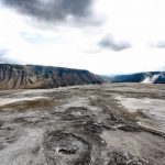
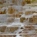
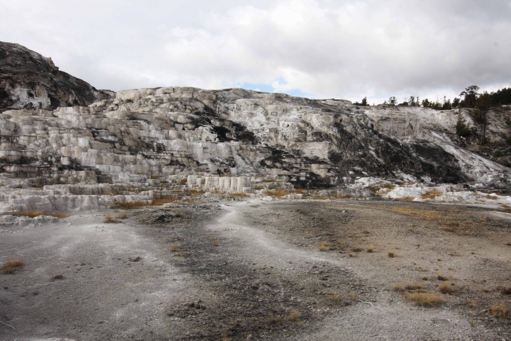
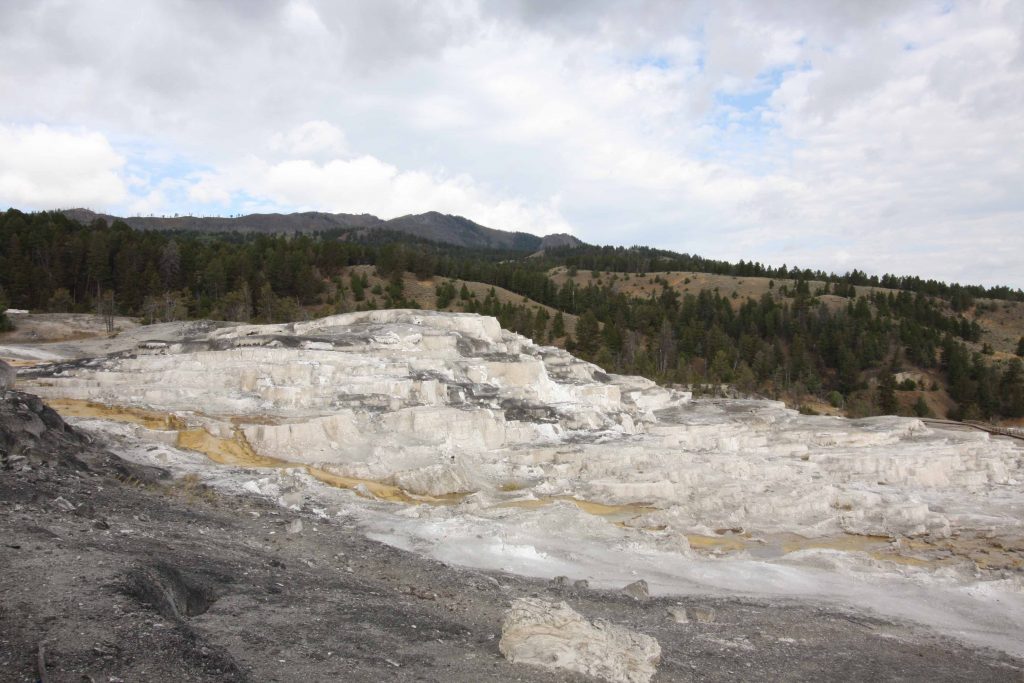
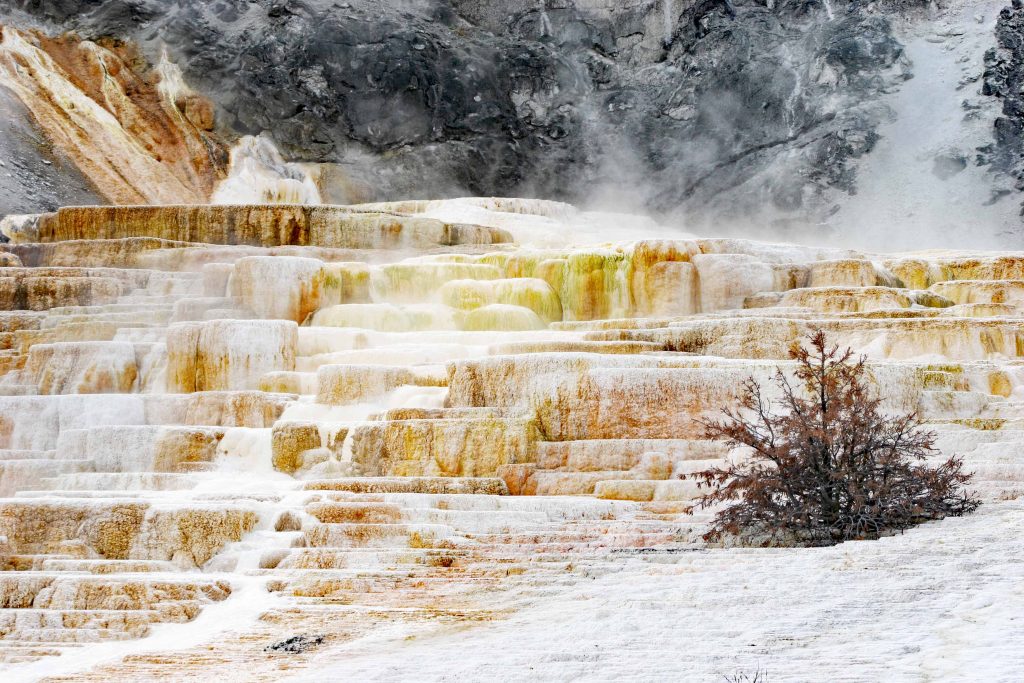
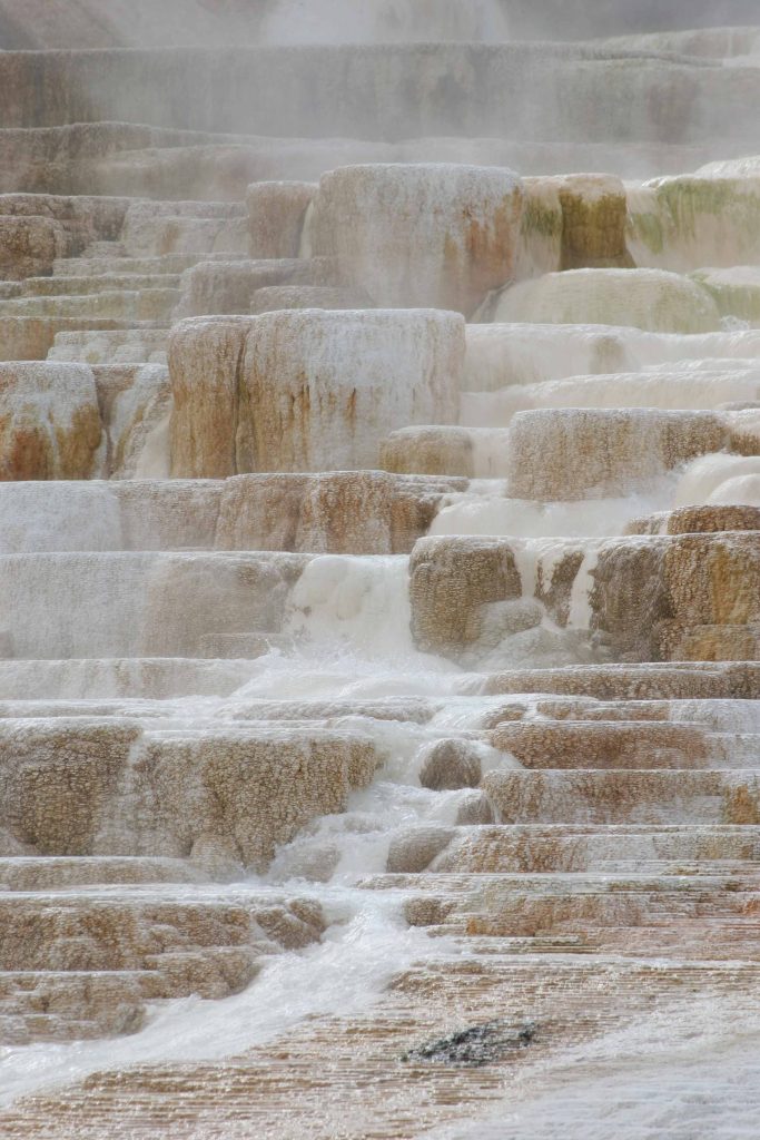
MAMMOTH HOT SPRINGS
The closet area to visit coming through the north entrance is Mammoth Hot Springs. Various minerals are crystalizing after emerging from the ground. The following pictures are capture this activity.


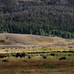
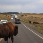
Driving south you may encounter bison grazing in the meadows.

Driving back from Mammoth Hot Springs this herd of bison was spotted off the road.

The herd was well off the road.

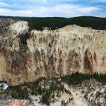
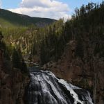
TOWER FALLS
Tower Falls is in the northeast corner of Yellowstone National Park. From the Albright Visitor Center at the north end of the park drive east and
than south on the Grand Loop Road Canyon Tower to the falls. From the Canyon Village Visitor Center at the center of the park drive north on
Grand Loop Road Canyon Tower to the falls.


At this point should the journey continue to Old Faithful or turn to Canyon Village. Canyon Village is much closer. It depends where your accommodations are. There is a campground, cafeteria, general store, and new accommodations in Canyon Village. If you do not mind a walk the north rim of the Grand Canyon can be reached by foot. Parking is an issue along the north rim. However, the south rim can be reached by bicycle and car easily. The following are photographs of this canyon and waterfall.
WEST ENTRANCE
The west entrance is through West Yellowstone, Montana on Route 20. The population is about 1,400 in 2018. This entrance is closer to Old Faithful and the Geyser Basin and Canyon Village.
Canyon Village
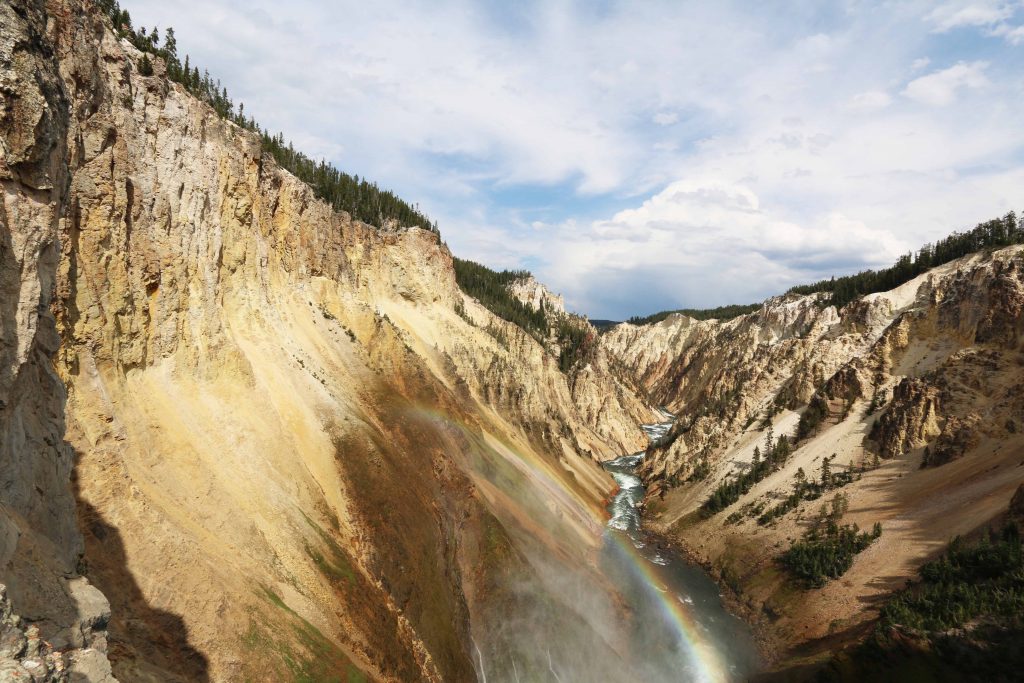
Canyon Village has a cabins and campground as well as modern motels. It is close to the Grand Canyon of Yellowstone. The following photographs are of the Grand Canyon and the waterfalls.

Walking down the trail to the falls.
IN JUNE OF 2022 YELLOWSTONE WAS CLOSED BECAUSE OF FLOODING.
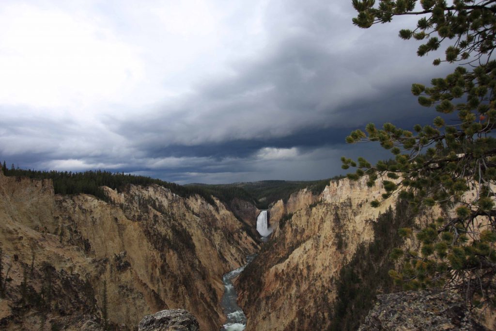
A view of the upper fall from the new viewpoint on the south rim of the Grand Canyon of Yellowstone two days before the park was closed in 2022.

The river between the two falls with a normal flow.

The top of the lower fall when normal water flow.


The south rim views.


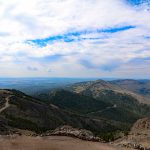
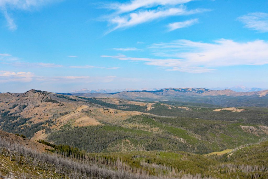
MOUNT WASHBURN
Just north of Canyon Village is Washburn Hot Springs Overlook. Before coming over Dunraven Pass is a parking lot. This lot will not accommodate large vehicles. The parking is limited. This is the trailhead to hike up Mount Washburn. Besides this way up to the top, there is a bike trail up to the top. To reach this parking lot go over the pass and as you round the mountain, you will come to Chittenden Road. This road was not paved in 2018. At the end of the road is large parking lot. It will accommodate vehicles with trailers. The bike trail starts here. The following pictures were taken by hiking up the trail. Only a few bicycle riders were encountered.

A view from the bike path looking to the west.

A view looking more to the south.


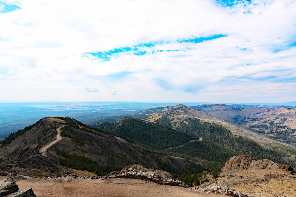
This view shows how much the elevation gain has increased.


This is a view closer to the top.


Looking back to the start of the bike path.


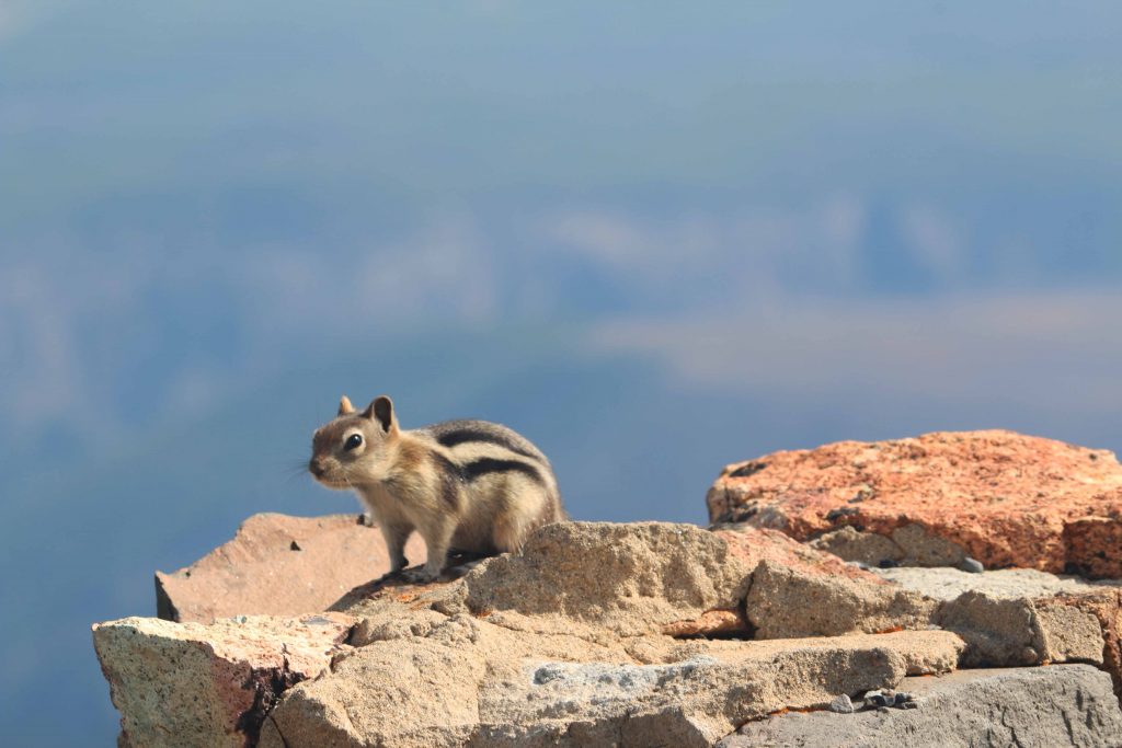

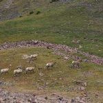
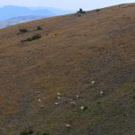
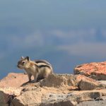
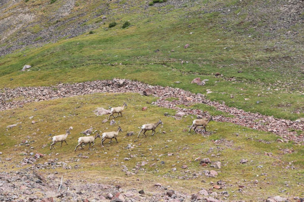
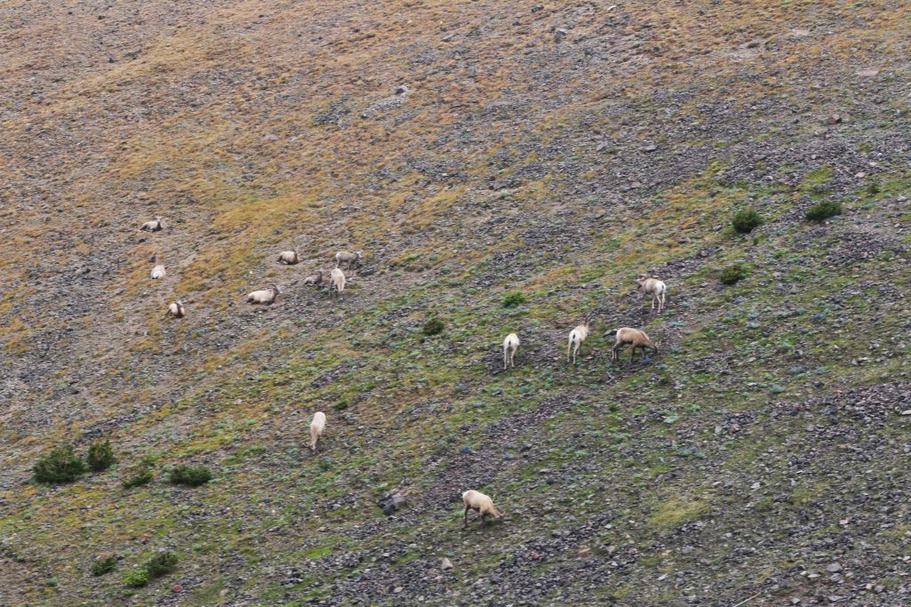
ANIMALS AT THE TOP


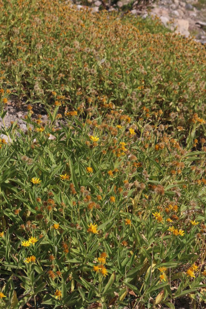
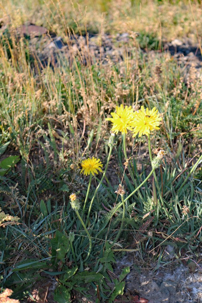
THE FLORA ALONG THE WAY


THE RETURN

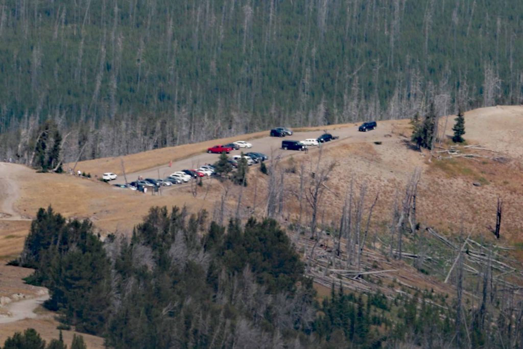 A view of the parking lot at midday in August from the top.
Situational Awareness
The parking lot brings two things to mind First, there is a tip about hiking to the top. You have to make mental notes what was along the trail as you hike. In aviation there is a concept that has to be followed. It is called situational awareness. If this principal is not followed there can be a problem. Returning to the bicycle parking lot, there was a couple and a young lady ahead of me. There was conversation between the couple that they did not recognize the parking area. At the same time a docent was driving a pickup truck down the bike trail from the top. The couple asked where the other parking lot was. He explained that they would have to go back up the trail and come down the other side. They explained that they could not make the walk. A ride was offered to them. The young lady asked if she could ride as well. The docent said no. He did not have room for her. A two and half hour walk up and down would be required. Since this conversation was overheard, a ride was offered to the young lady. She accepted. Her mother was waiting in the other parking lot. The daughter was happy to reunite with her mother.

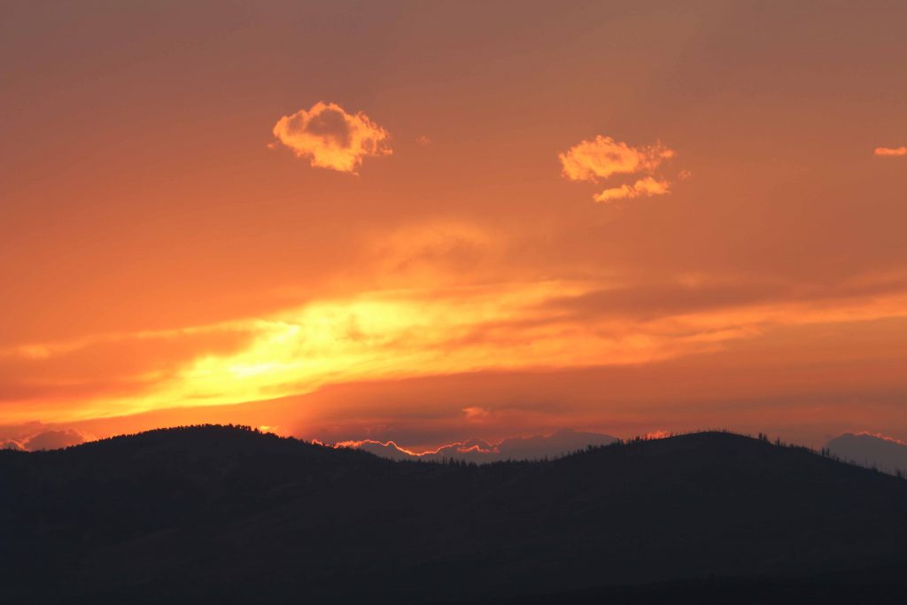
Viewing of a Sunset.
Since the parking lot is above the road that goes around Mount Washburn and is on the west side, it is a good place to have an unobstructed view of the sunset. The following photographs capture the sunset from this vantage point.


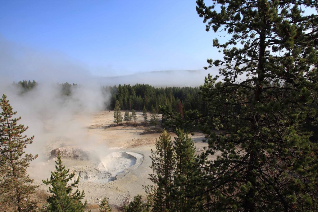
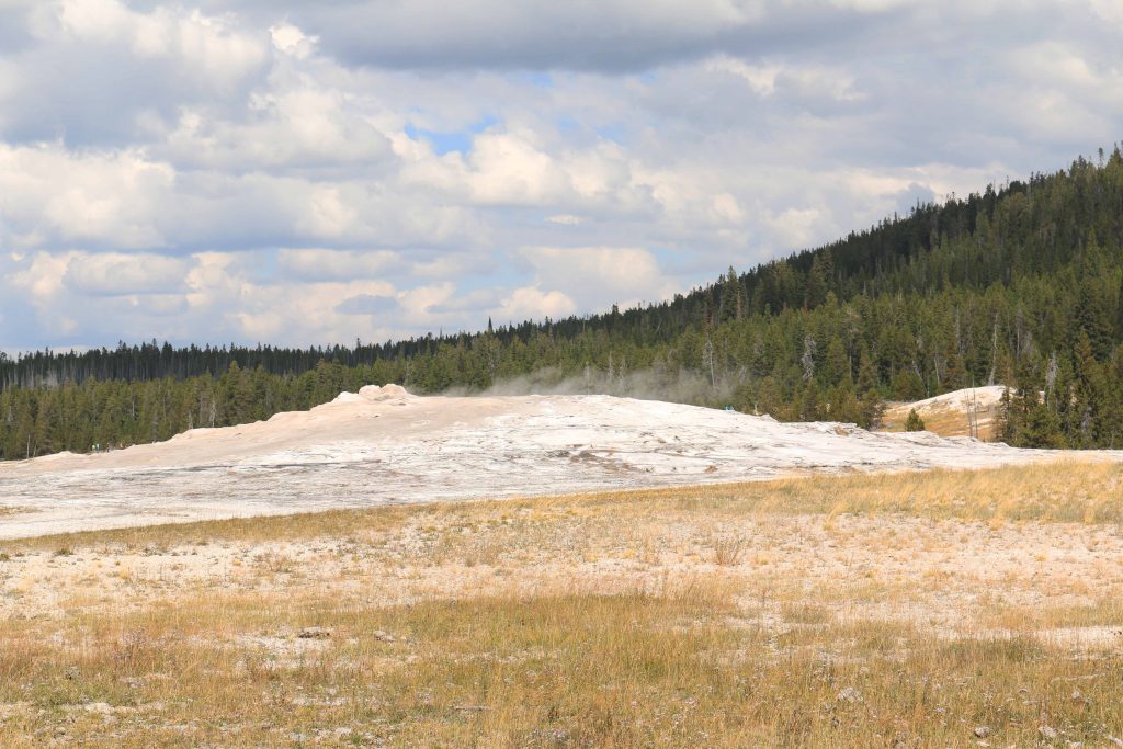
GEYSER BASIN
Upper Geyser Basin
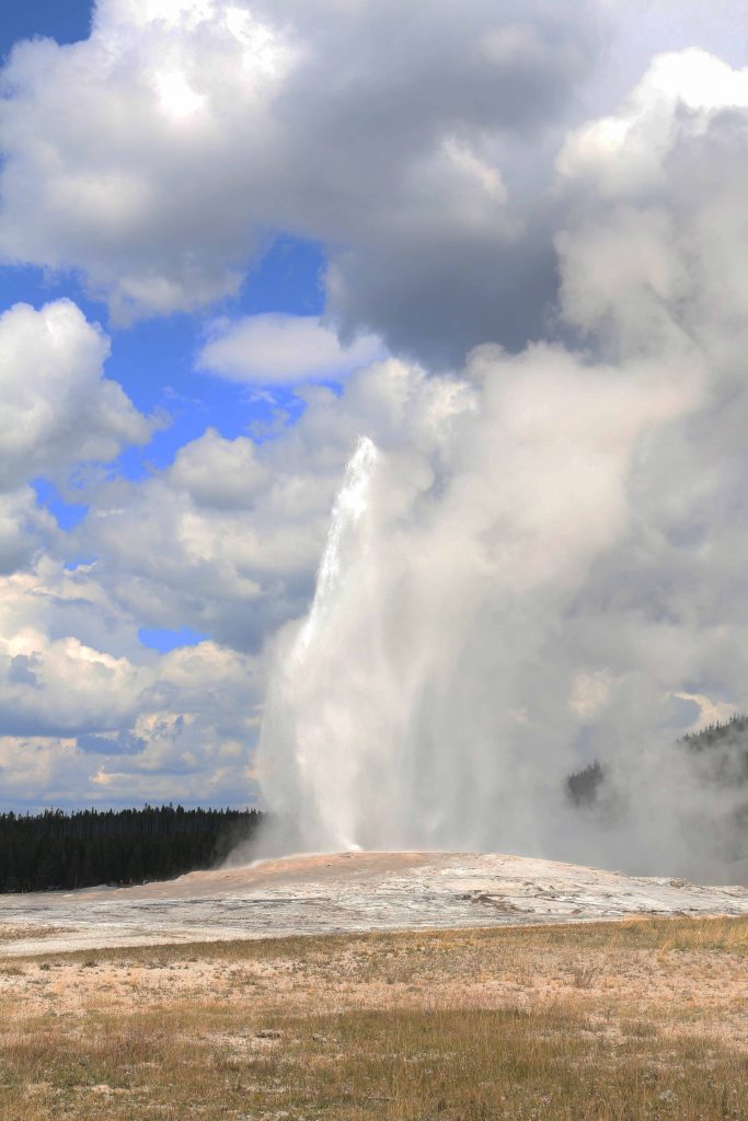
OLD FAITHFUL
As mentioned earlier, viewing Old Faithful eruption is very popular. The viewing area surrounds the many geysers completely. It will accommodate crowds. The parking lot cannot accommodate everyone that would like to show up to see the geyser erupt. A suggestion would be to show up just after the eruption and look for a place to park as someone leaves.
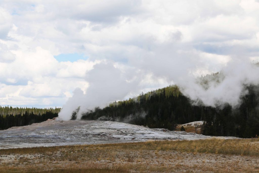


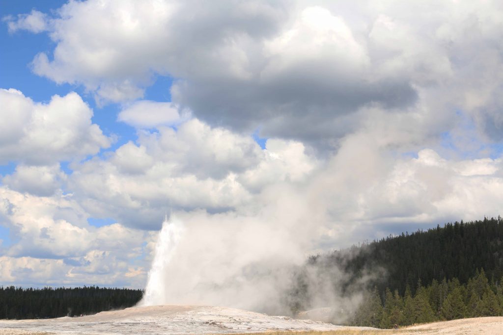
Then there is the iconic stream bursting out.


The stream becomes smaller.


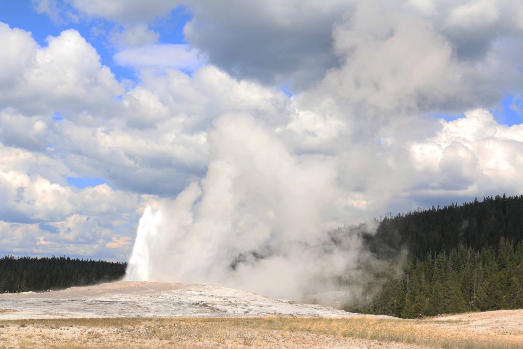


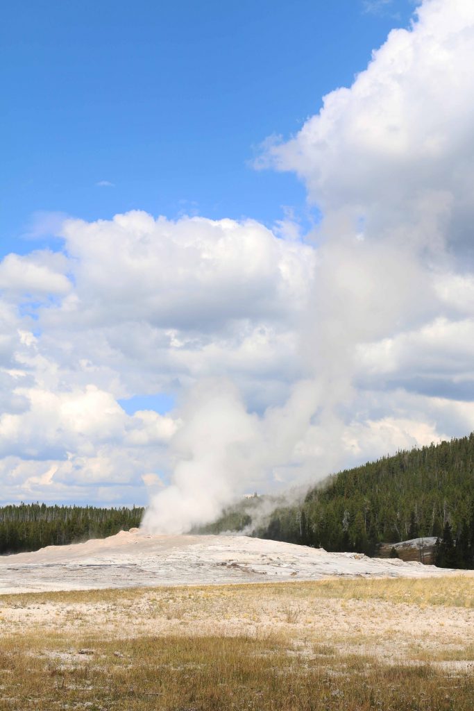
The stream than becomes steam only.

The park service offers a live view of Old Faithful. The link is:
http://www.nps.gov/yell/learn/photomultimedia/webcams.htm
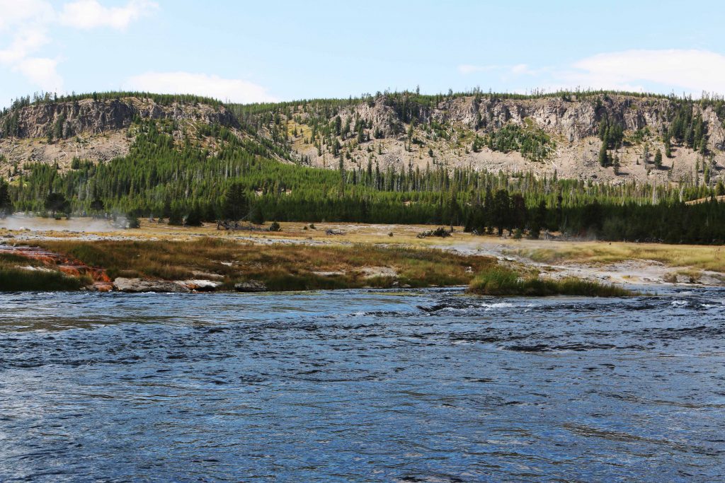
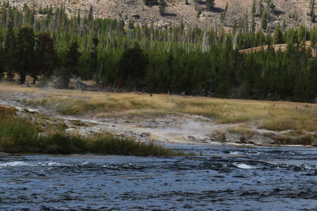
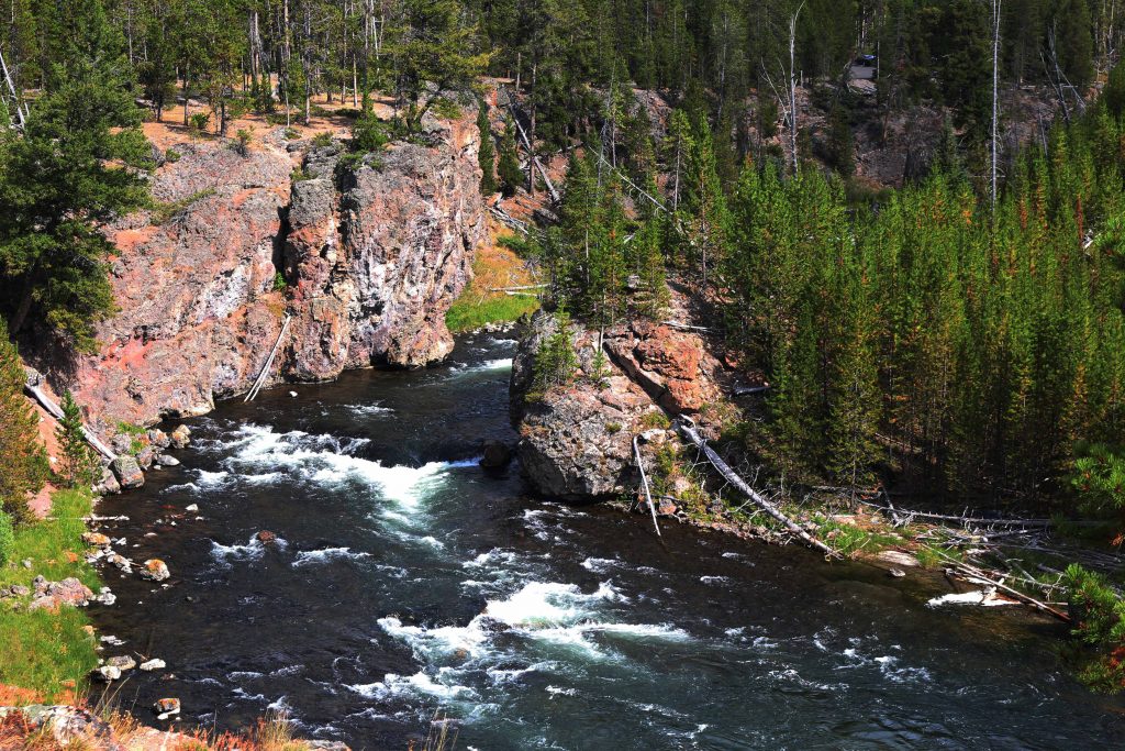
The following photographs continue down the Geyser Basin from Old Faithful down to Firehole Falls.


Hope you enjoyed this look at Yellowstone National Park.
Really good blog, thank you very much for your effort in writing this post.
You are welcome.
Val