
WHAT KIND OF TRIPS ARE OUT THERE
- Visit the upper peninsula of Michigan.
- What is on Lake Superior in Wisconsin.
- Visit Louisville, Kentucky.
- Visit Poverty Point World Heritage Site Delhi, LA.
- Hike up the south trail of Sandia Mountains, Albuquerque, NM
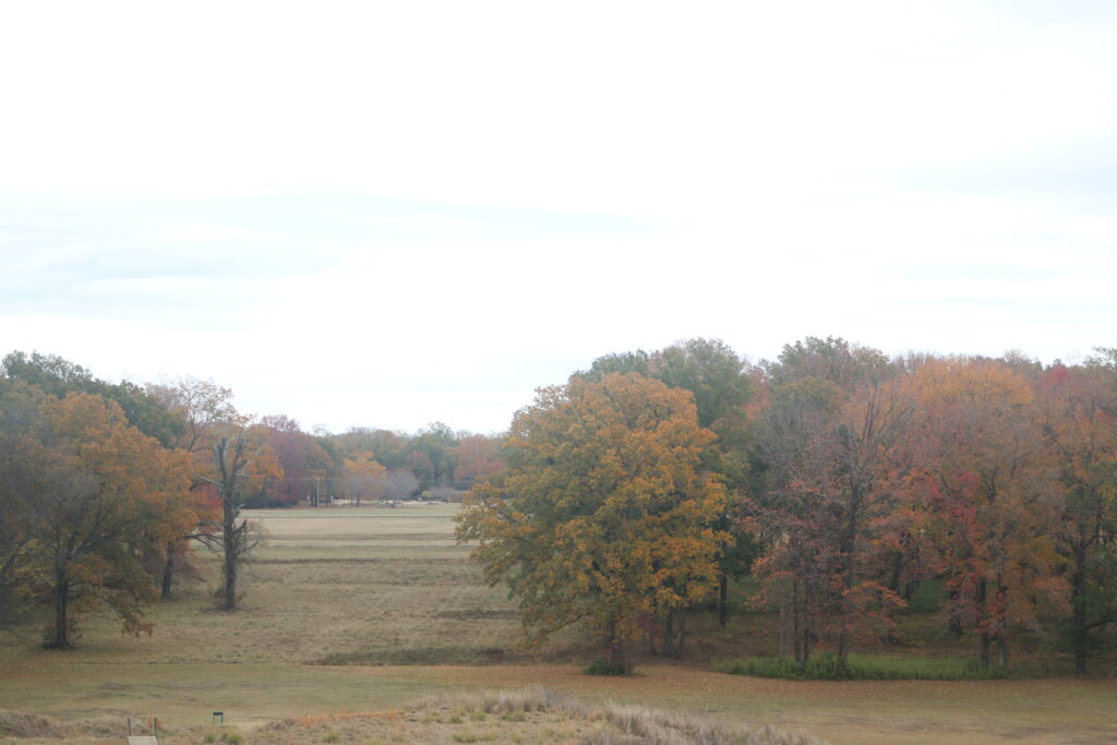
- Mississippi Gulf Coast
1. VISIT TO THE UPPER PENINSULA OF MICHIGAN
A visit to the upper peninsula has much to offer whether ski areas, waterfalls, the Mackinac Bridge, or lighthouses. In addition, there is Pictured Rocks National Lakeshore. Besides the sights and trails in this park, there are three campgrounds in the park with their individual rule and restrictions. Hurricane River has 11 camp sites. Some sites allow generators. There is a length restriction. The vehicle cannot be longer than 36 feet and a vehicle with a trailer cannot be longer than 42 feet. Twelve Mile Beach has 36 camp sites. No generators are allowed. There is a length restriction as well. The vehicle cannot be longer than 36 feet and a vehicle with a trailer cannot be longer than 42 feet. Little Beaver has 8 camp sites. No pets are allowed.
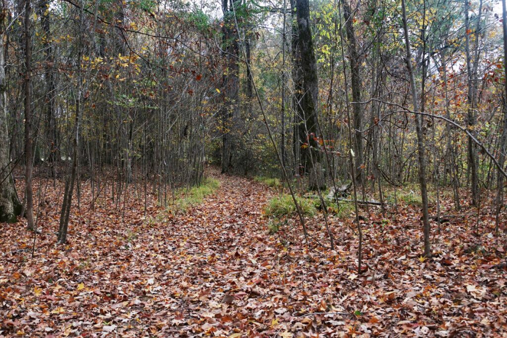
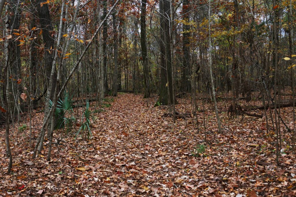
The summertime activities are hiking, bicycling, boating, fishing, sea kayaking, swimming, snorkeling, scuba, and wading. It would take days to hike the 100 miles of hiking trails.
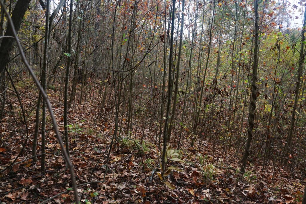
The park is open in winter for snowshoeing, cross-country skiing, ice climbing, viewing ice curtains, snowmobiling, or backcountry camping. A few of the sites are pictured below.

The visitor center is at the eastern end of the park.
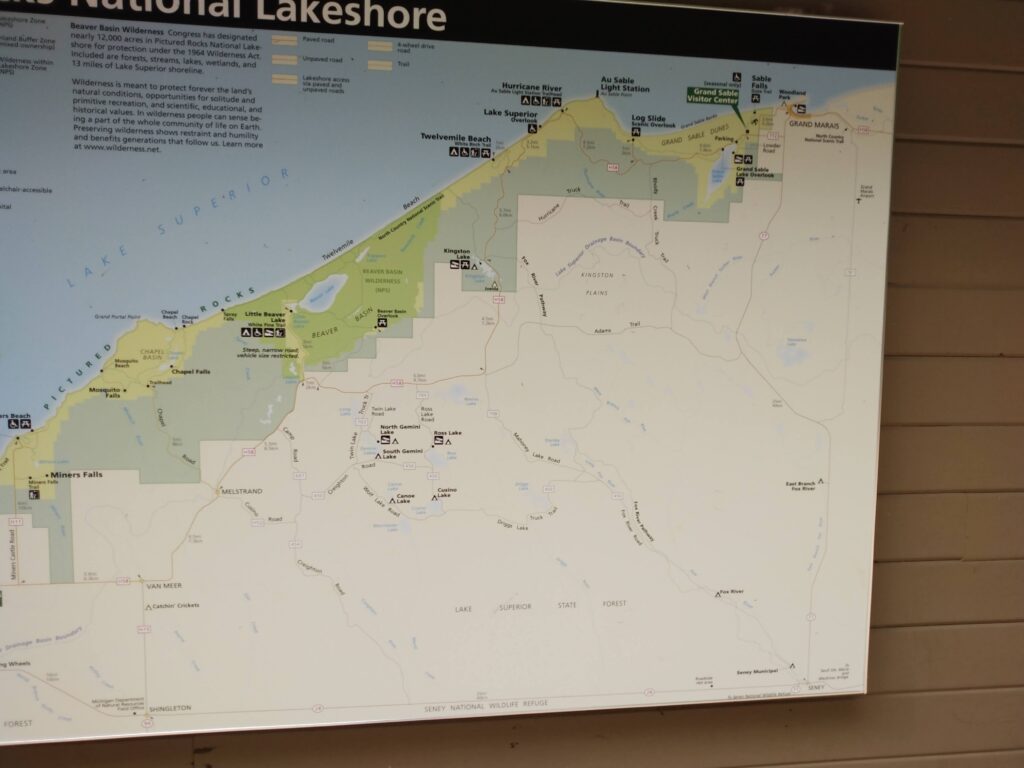
The general view of map of the park. Go to the website for viewing the map in detail.
The photographs and commentary start at the western end of the park.

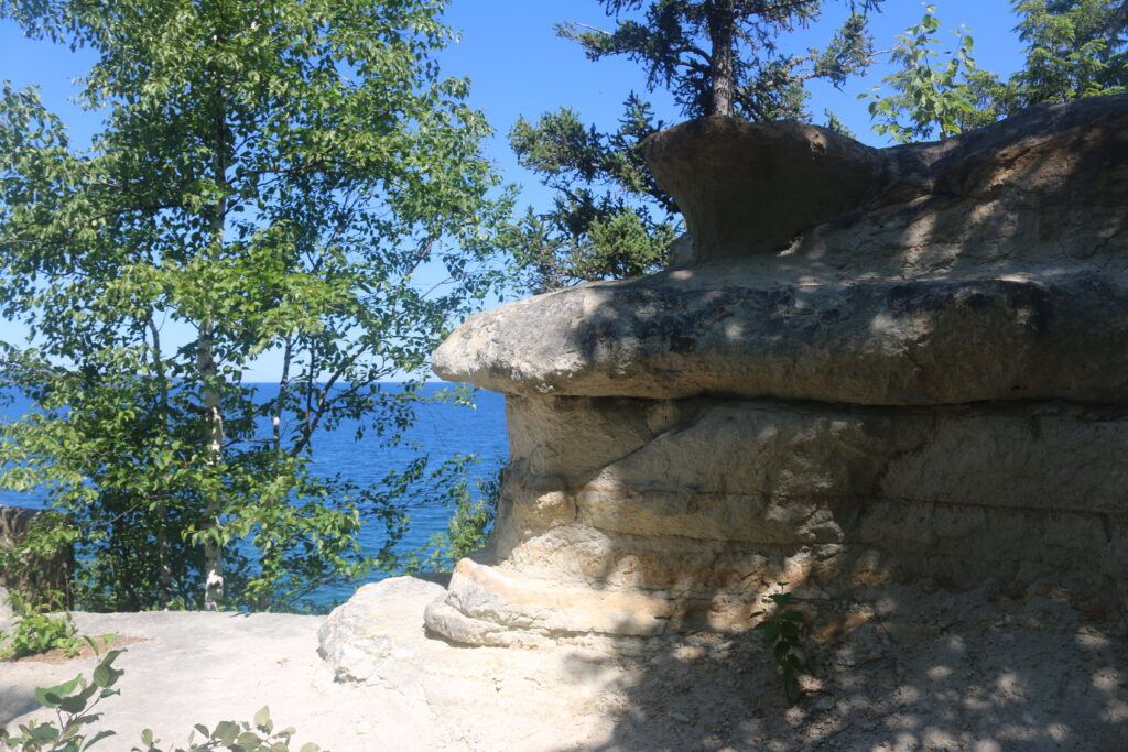
A viewable rock at the western end of the park.
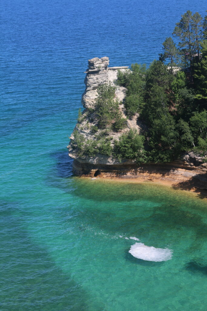
A closer look.

A view looking east as you walk out to the rock.
The walk continues to the end.
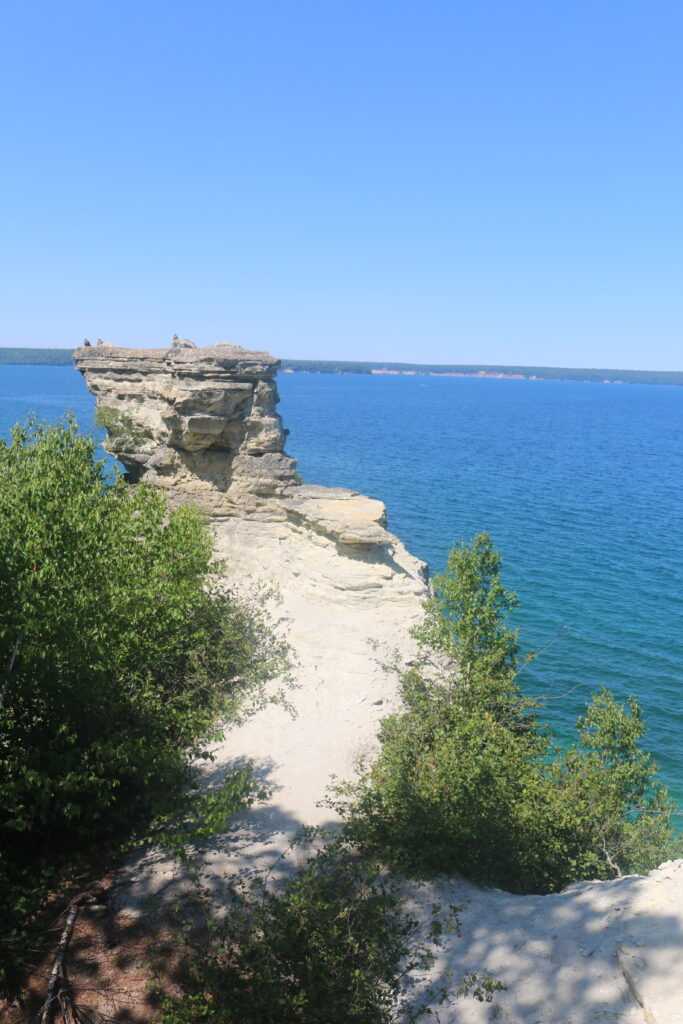
The end of the walk.
Moving further east The Twelve Mile Beach can be reached.
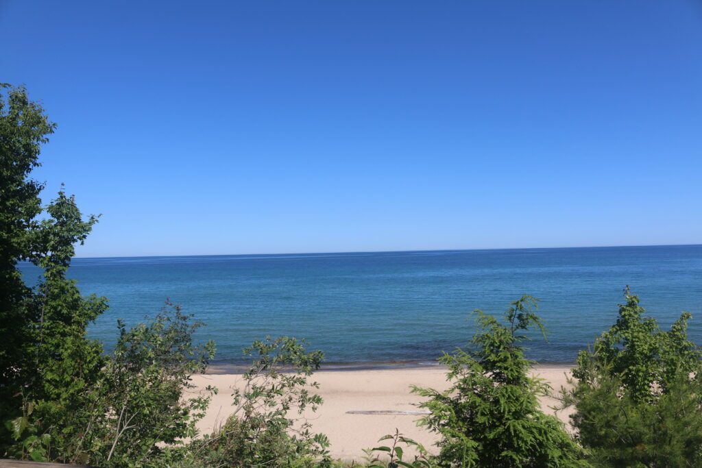
A look at Twelve Mile beach. Note the beach has no rocks or high dunes that exist at the east end of the park.
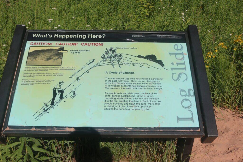
The journey continues east to the Log Slide.
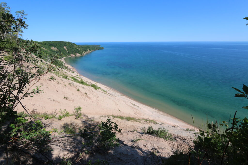
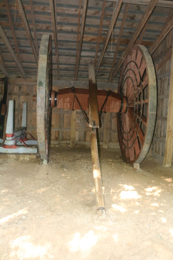
Looking down the Log Slide. It is 300 feet to the lake from the top. Or as the ranger states if you go down it will take you an hour or more to climb back to the park. The Au Sable Lighthouse. It is a good hike to get there.
How steep is steep hill? This is the log slide that was previously used for logging. At the top of the slide is a shed with the equipment that was used.
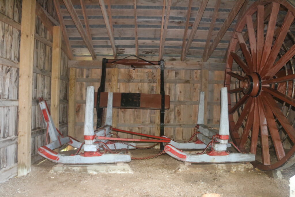
Sleds or skis?
4444
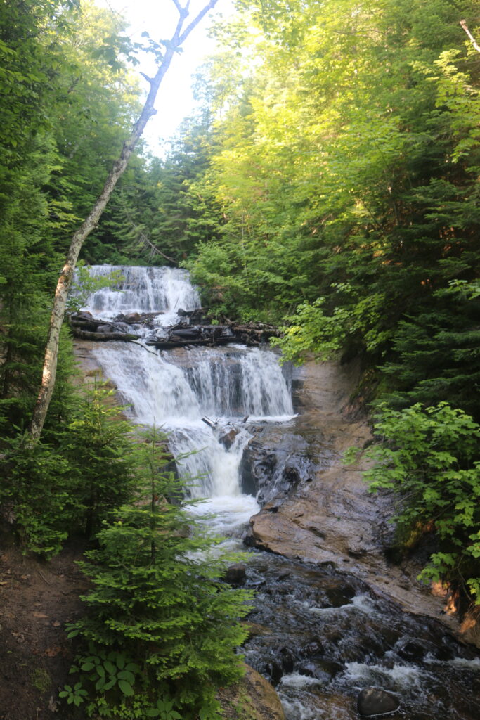
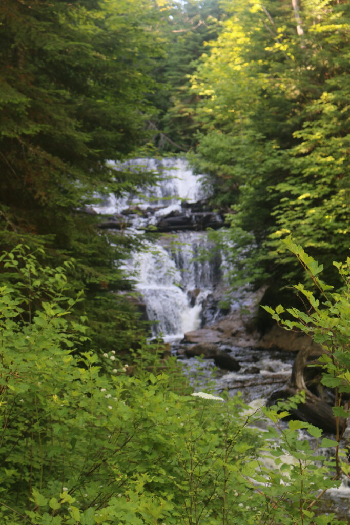
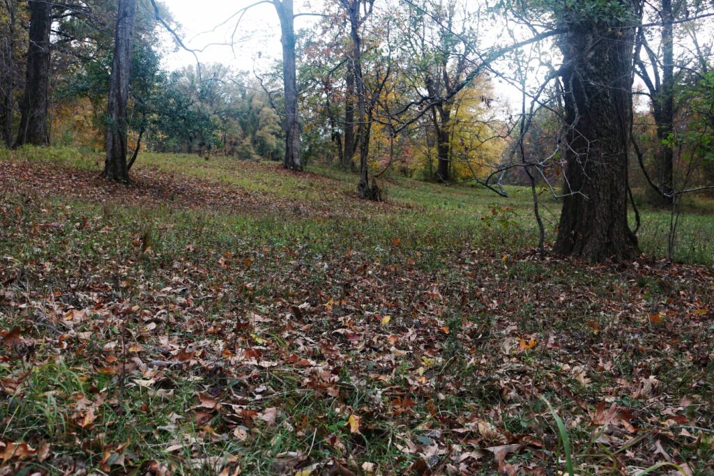
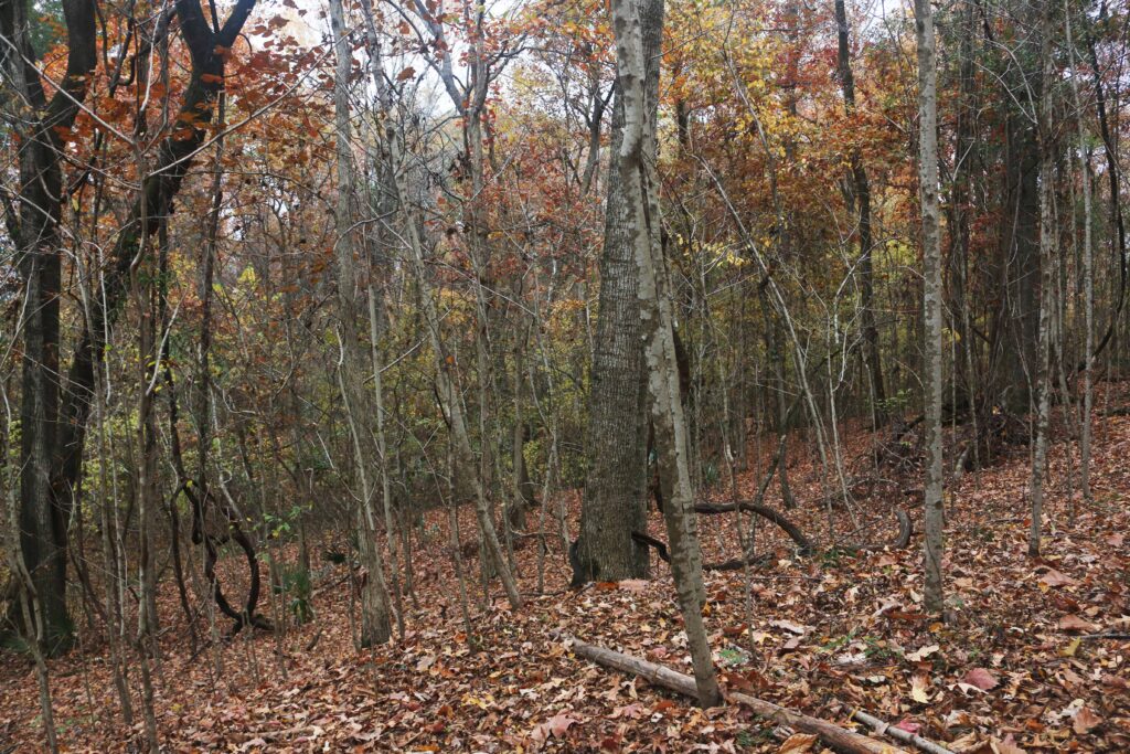
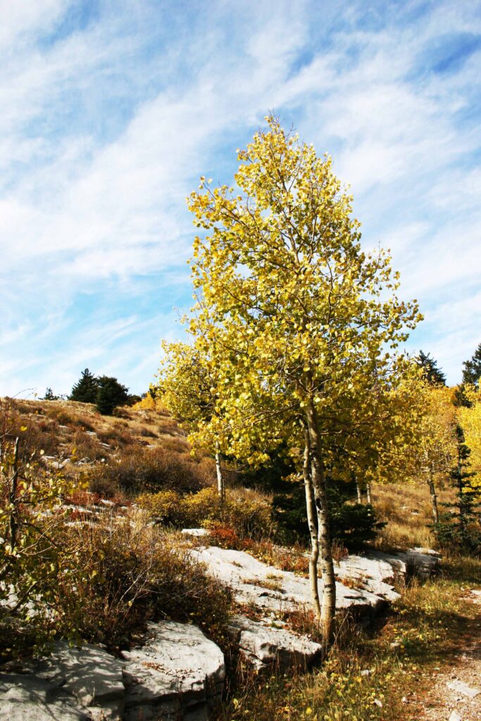
What else is in the park? Dunes are in the park. Hikes to many waterfalls.
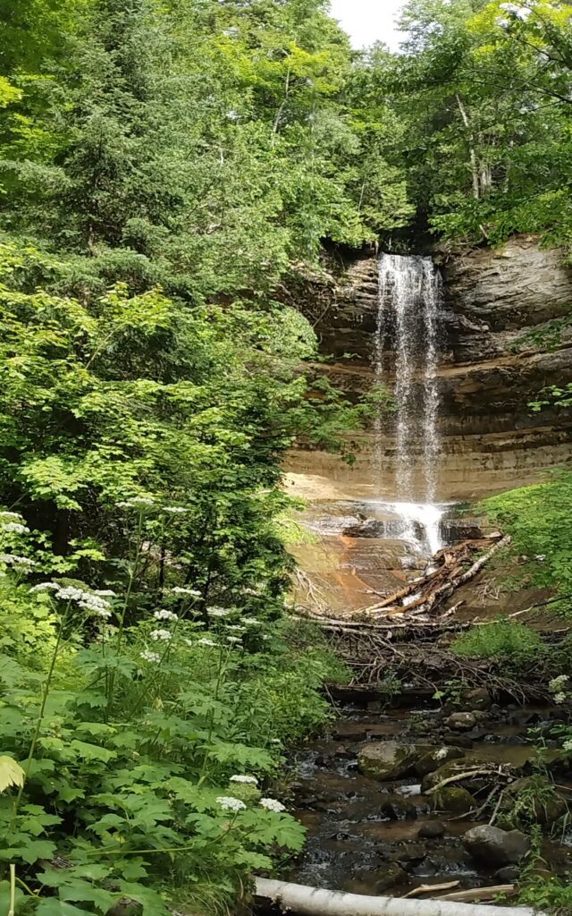
One of the many waterfalls.
Another waterfall at the end of a trail.
Sunlight above.
Removal of overexposure.
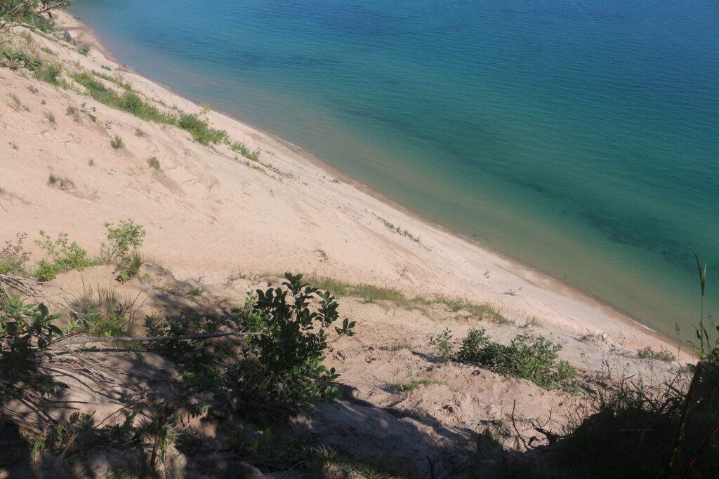
The hike to the beach to look up to the dunes.
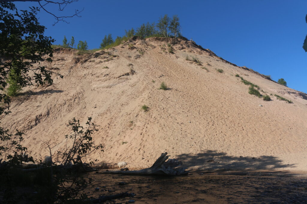
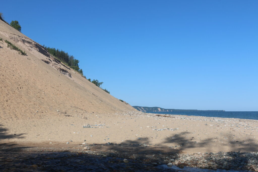
The beach at the base of the dunes.
______________________________________________________________
______________________________________________________________
2. What National Lakeshore is on Lake Superior in Wisconsin?
ANSWER: Apostle Islands National Lakeshore.
Where is Apostle Islands National Lakeshore?
ANSWER: Bayfield, Wisconsin.
Bayfield, Wisconsin is the “Gateway to the Apostle Islands National Lakeshore”. Conde Nest Traveler has identified this city as a 2023n Best Places to go in the USA. USA Today Readers’ Choice as 10 Best Coastal Small towns. This community holds the title of the Berry Capital of Wisconsin. On Tuesday and Thursday from June to August there are concerts by lake.
There are activities all year around.

Looking east toward the lake driving through town,

The other side of the street.
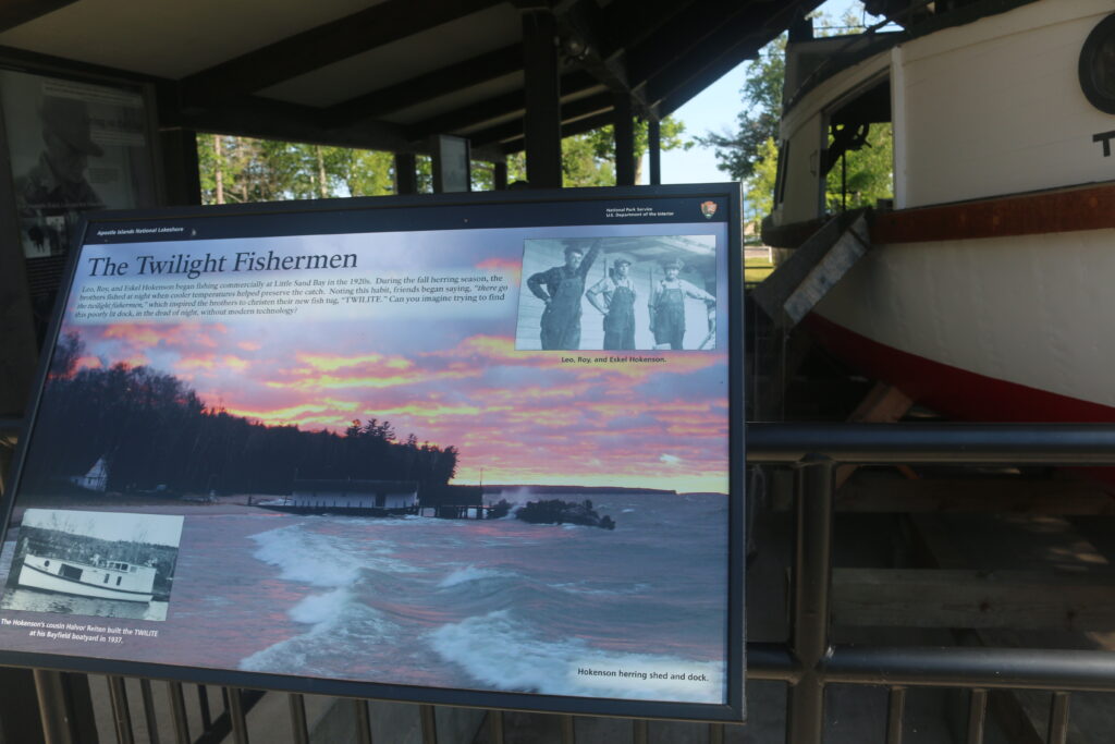
Apostle Island National Lakeshore.
Some distance from Bayfield, the Park Service has its facilities. From the visitor Center, campground, kayak launch facility, and display.
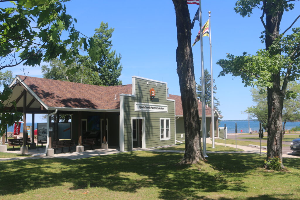
The visitor Center.
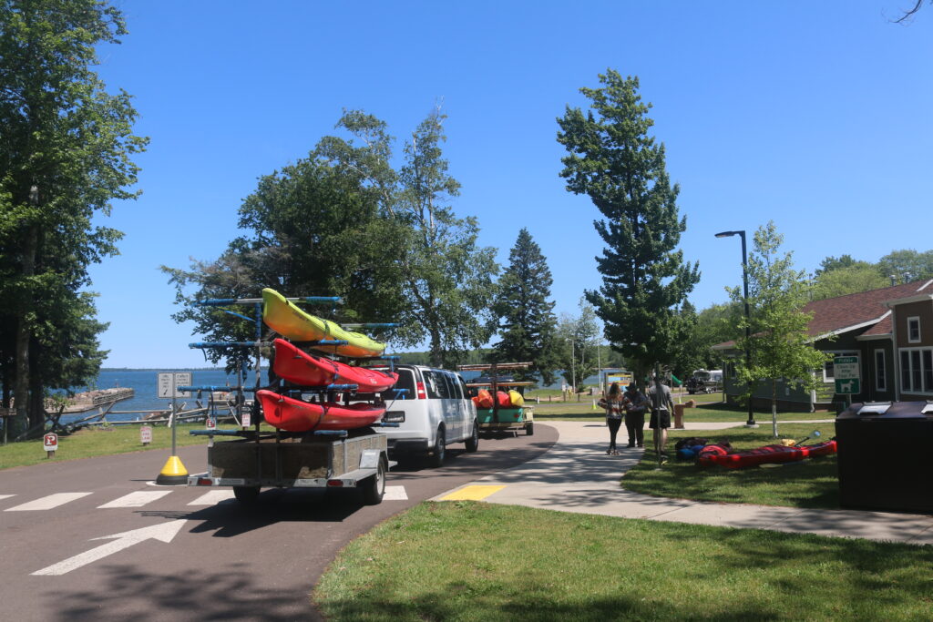
The inspection of kayaks before launching into the lake. Yes, a ranger does make an inspection.
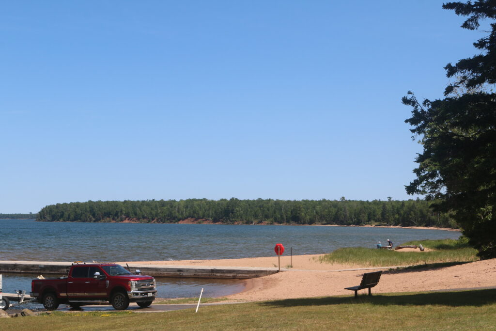
The boat launch. There is a beach to launch the kayaks.
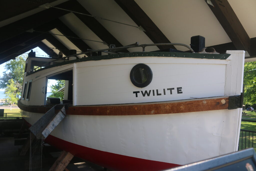
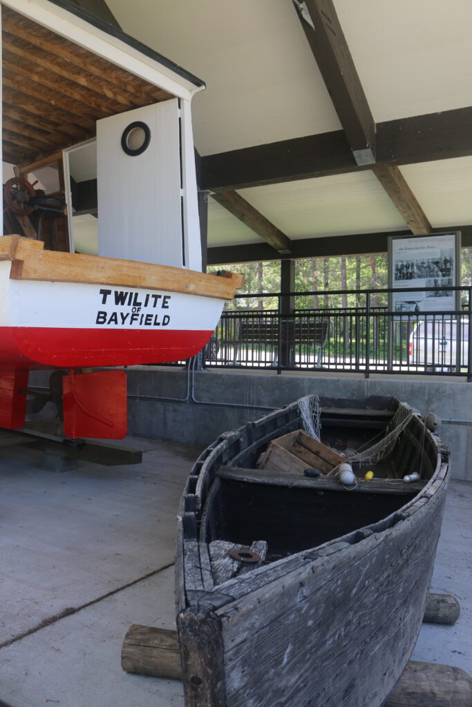
The display and story of how this area was fished. The boat that was used.
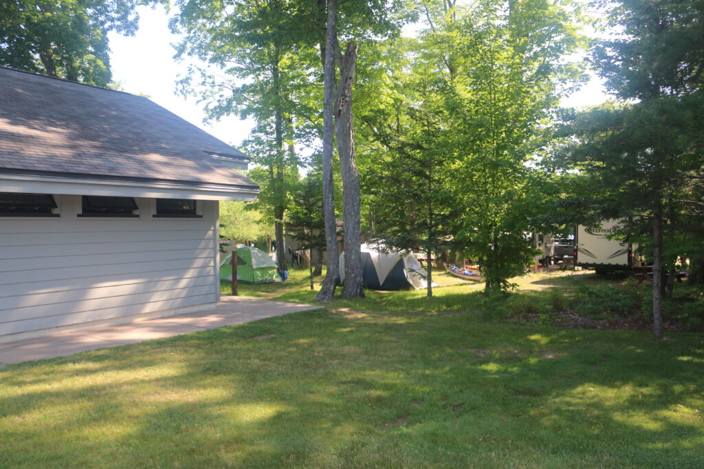
The campground across the street.

_____________________________________________________________________________________________________________________
______________________________________________________________________________________________________________________
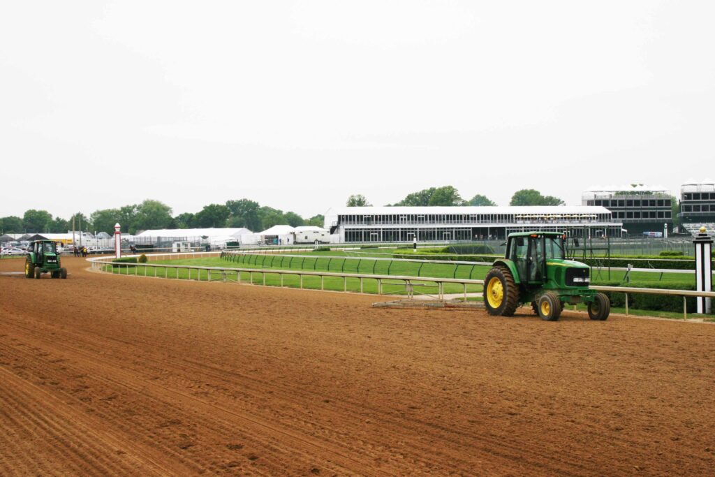
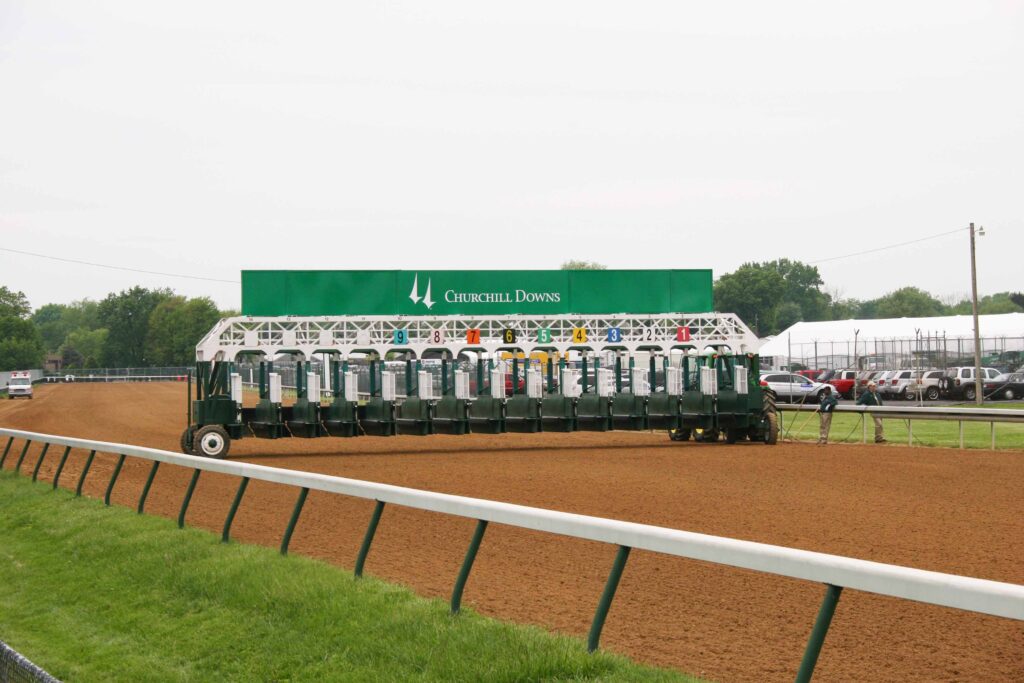
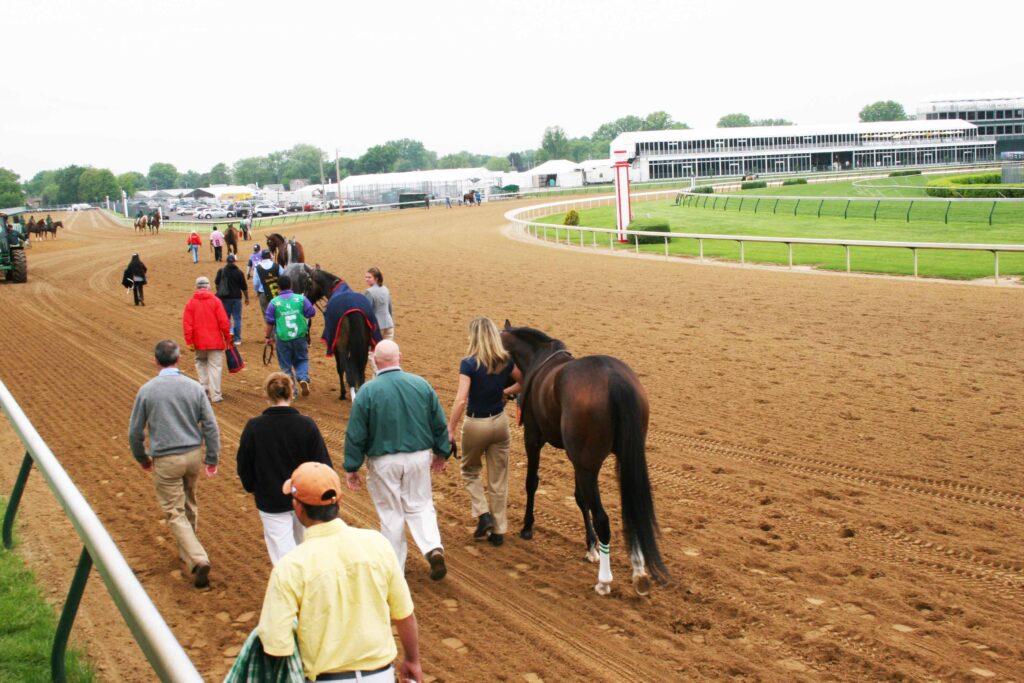
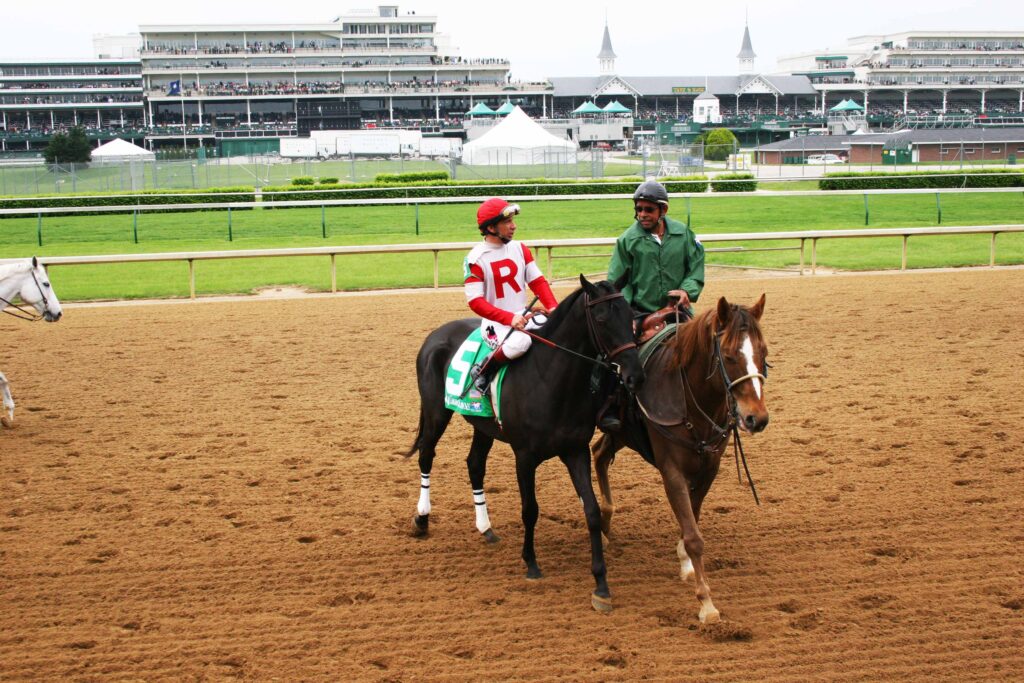
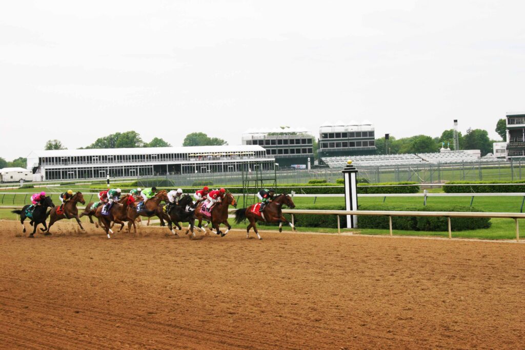
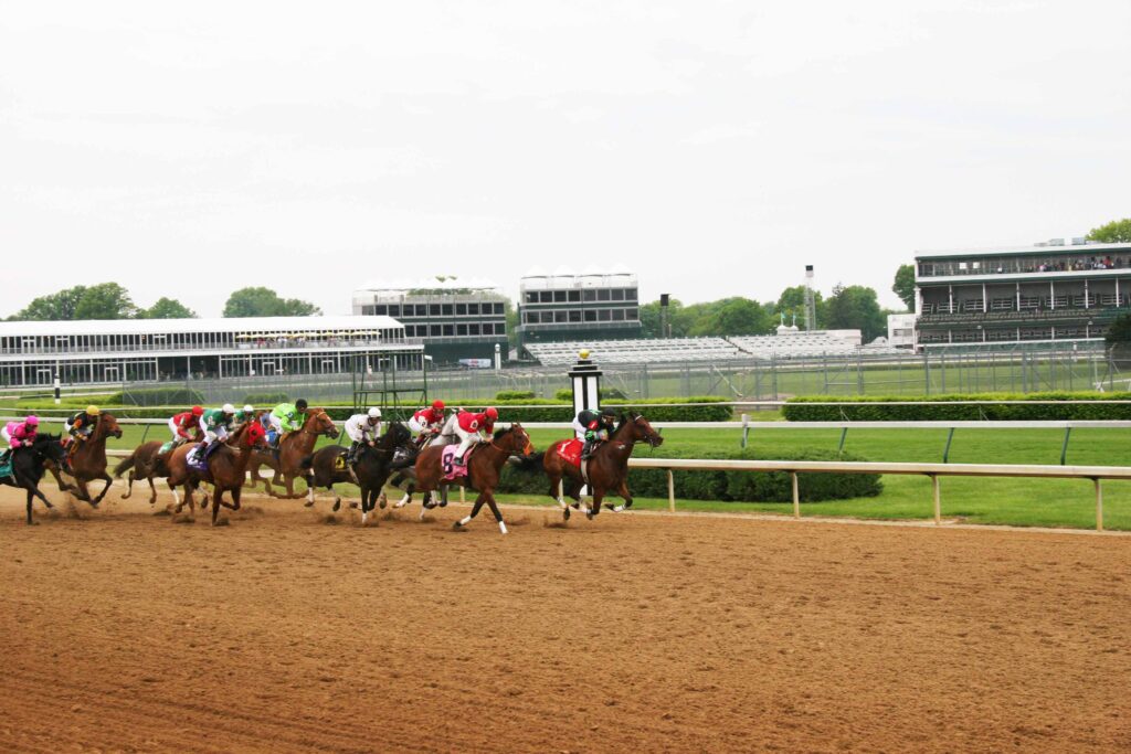
3. Visit Louisville, Kentucky.
A visit to Louisville has points of interest. A few individuals to not enjoy crossing the bridge over the Ohio River. Once in Louisville, there are things to do. Churchill Downs, Kentucky Derby Museum, Louisville Slugger Museum & Factory, Muhammad Ali Center, and many tours and activities. Racing horses in the Kentucky Derby Museum is fun and competitive. Attending the horse race at Churchill Downs on Derby Day is not easily done. Some pre-derby races are easier to view.
.

There is a Detention Barn for horses.
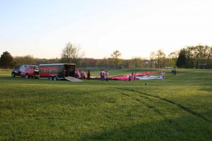
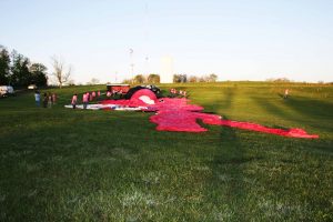
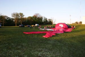
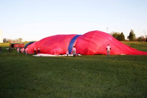
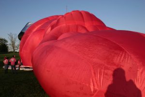
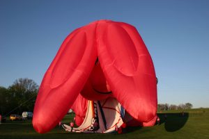
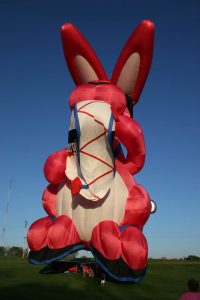
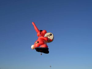
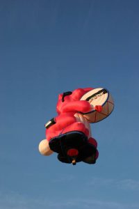
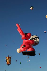
Attending the Kentucky Derby years ago, a new Energizer Bunny system was delivered. This hot air balloon is a larger-than-life icon for Energizer Battery. The Bunny is over 188 feet tall when inflated. The fabric alone weighs over 1,140 pounds. It takes a crew of at least 20 to inflate and deflate the envelope. Beside removing and stretching out the fabric so that the envelope looks like the bunny flat on the ground, 44 Velcro vents have to closed and checked. When this is completed, a fan is used to cold air into the envelope. When enough air is added so that the burner’s flame will not burn or scorch the fabric, the burner is ignited, and hot air is now added to the envelope. The first series of pictures shows the inflation. Other pictures are added to show where the Bunny has gone.


______________________________________________________________
_______________________________________________________________________________________________________
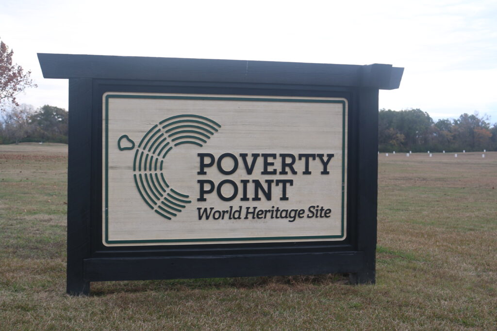
4. VISIT POVERTY POINT WORLD HERIGAGE SITE, EPPS, LA
Poverty Point World Heritage Site is 28 miles west of Vicksburg, MS and 15 minutes north of Delhi, LA and thirty miles east of Monroe, LA. The site has a museum with artifacts and a guide to walk through the site. Pictures will follow.

The museum building.
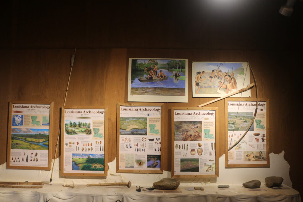
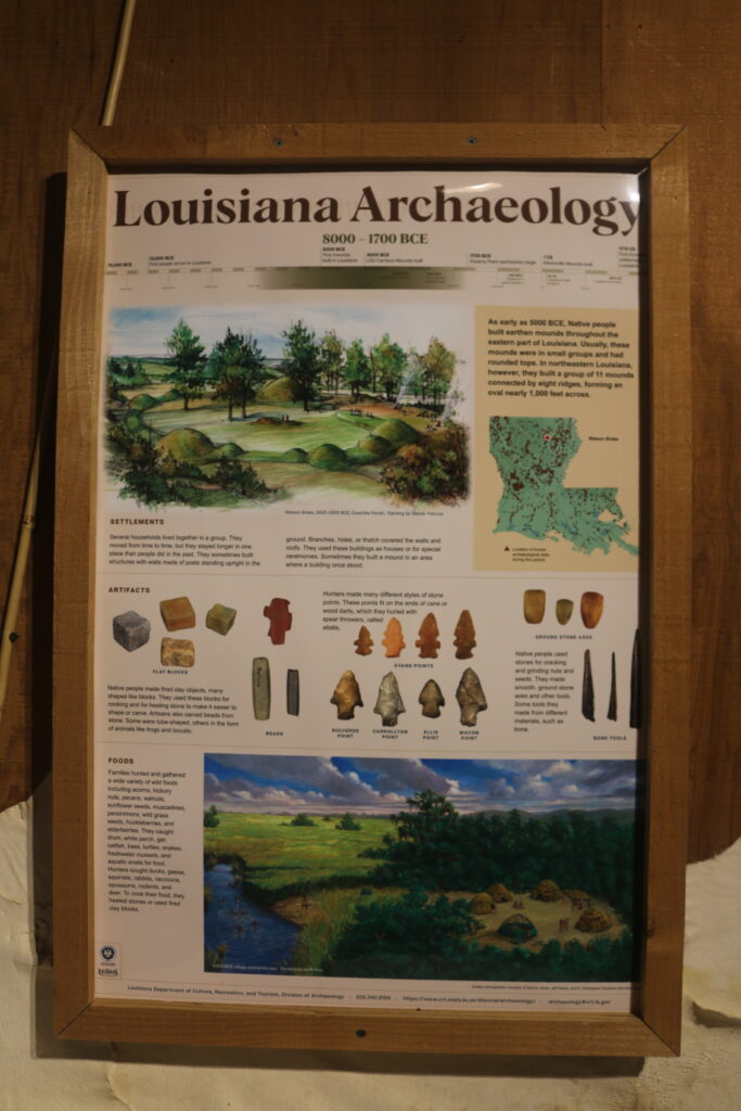
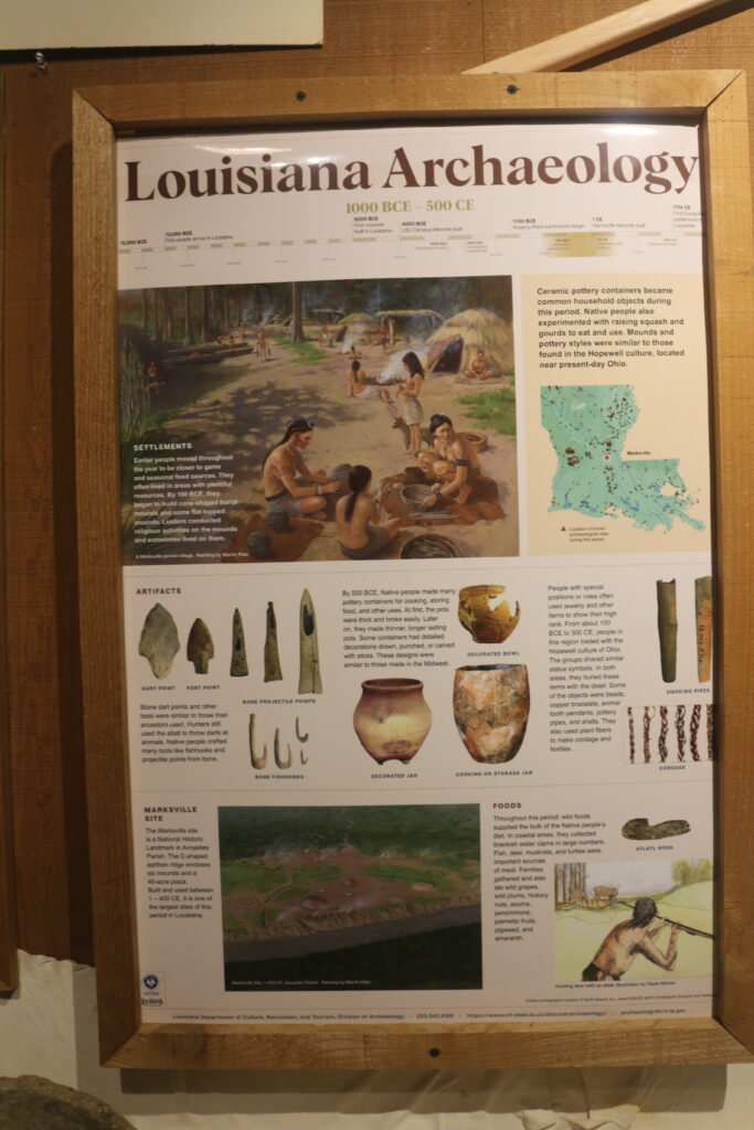
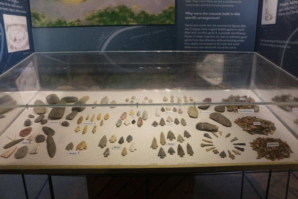
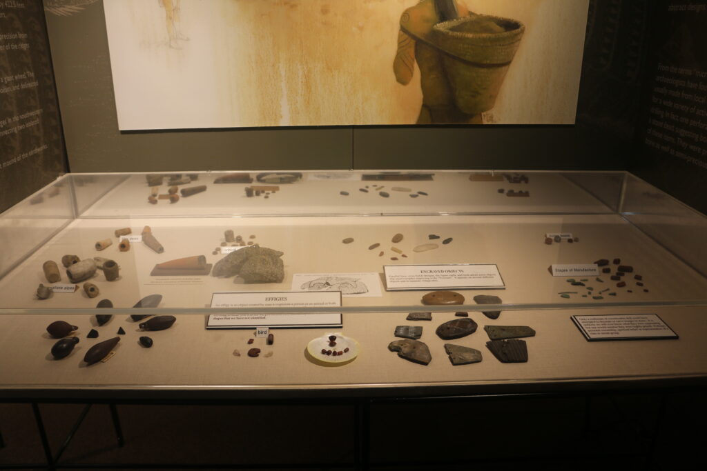
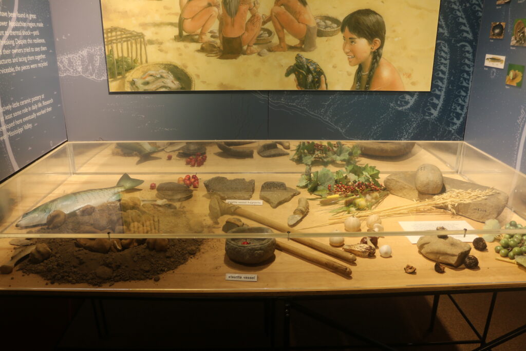
The museum offers a video to offer some theories of occurred here 3,500 years ago. There are display cases of artifacts with interpretations. Pictures follow of the display cases.


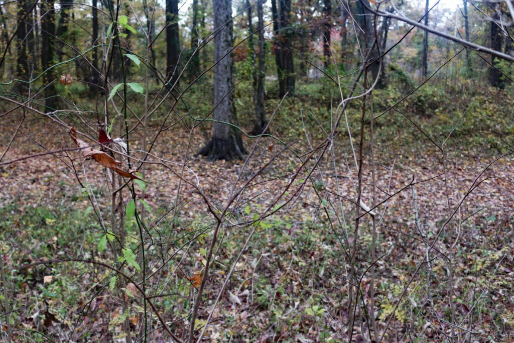
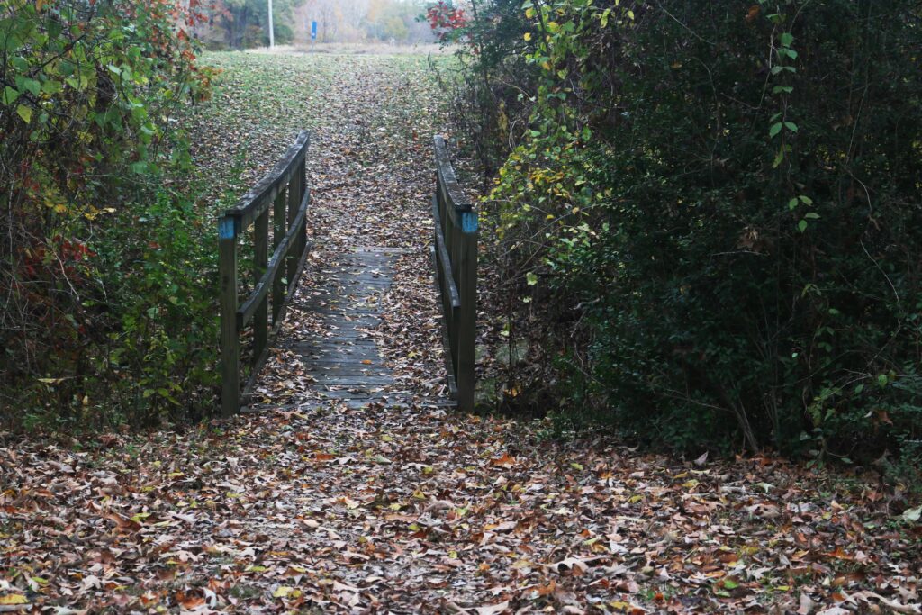
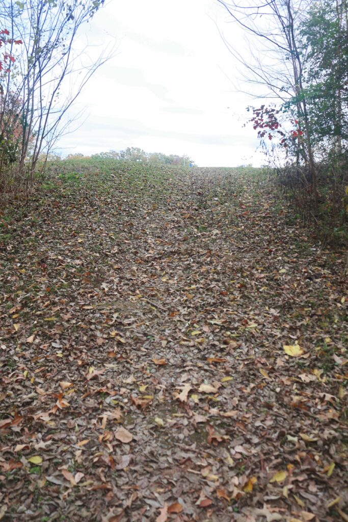
After visiting the museum a walking or driving tour of the site can be made. The walking tour is just over two miles. The terrain is fairly level on the walk. However, if you decide to climb the largest mound a may be a bit much. The following photographs were taken on the walking tour.
The text that follows is from the walking tour guide. The pictures were taken around each station.
INTRODUCTION
Many countries have archaeological sites that provide a tantalizing glimpse into the human past. These sites include the Lascaux cave in France, Stonehenge in England, and the Pyramids of Giza in Egypt. Here in Louisiana, the Poverty Point World Heritage Site also offers a unique view into human prehistory. Around 1650 BC, American Indians began to build the massive earthwork complex of mounds and ridges that today makes up the Poverty Point World Heritage Site. These people had no wheelbarrows, wagons, or pack animals to move the dirt; they only had baskets, simple tools, and their own labor. The level of organization needed to build the earthworks in this environment was exceptional for a group that did not practice agriculture—they were hunters and gatherers. We don’t know what the American Indians who built these earthworks called themselves or this place. Poverty Point was the name of the historic plantation established at this location by 1850.
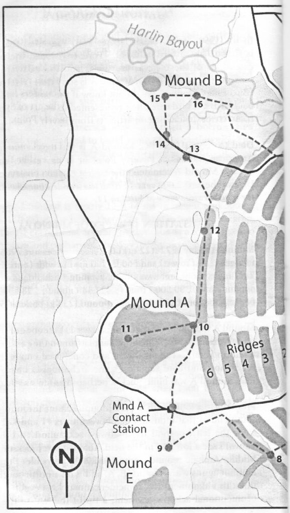
TRAILHEAD
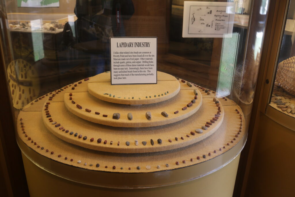
You are standing on Macon (pronounced may-sun or may-kun) Ridge, which was formed 30-40,000 years ago when streams from melting glaciers deposited thick layers of clay with interspersed lenses of sand. About 12-14,000 years ago, loess (silt particles blown by the wind) covered Macon Ridge, adding about 13 ft (4 m) to its surface deposits. One of the most important implications of this geological history is that there is no naturally occurring stone—every rock that is found on the site has been brought from some other location by people. The prehistoric inhabitants got these materials through local sources 18-25 miles (30-40 km) away, and through trade or travel to the Appalachian Mountains, the Midwest, and beyond. Without horses or cars, the Poverty Point people likely traveled by water, using dugout canoes to haul tons of stone here to make into tools and ornaments.
From here, you can look down on the Bayou Macon (pronounced may-sun) and across, beyond the trees, to the Mississippi River floodplain. We don’t yet know if Bayou Macon flowed past the site during the Poverty Point occupation or if, as some archaeologists have suggested, there was a huge lake on the floodplain adjacent to Macon Ridge. In either case, we can be certain that the floodplain was a productive environment, rich in resources like fish, turtle, waterfowl, and aquatic plants, that was easily exploited by the Poverty Point people. The Macon Ridge upland would have provided a complementary set of locally available resources like white-tailed deer, opossum, nuts, fruits, and berries.
During the 1800s, steamboats paddled up the bayou on their way to pick up cotton at the town of Floyd, about 3 miles (4.8 km) north of here. And, in 1913, the avocational archaeologist Clarence B. Moore came up the bayou in his steamboat, Gopher, to excavate at Poverty Point. Bayou Magon plays no role in modern commerce, but the stream serves farmers’ irrigation and drainage needs and continues to provide a habitat for fish and other animals. Follow the edge of Macon Ridge southward to Station 1.
STATION 1 – THE TOP OF THE DOCK
As you approach this station, you will note a rise in elevation. This edge of the plaza has been enhanced by adding soils to create a low ridge. Archaeologists suggest that this enhancement produced a “wow” moment for prehistoric visitors who arrived at the site by water. The site remained invisible until visitors crested the ridge, at which point the grandeur of Poverty Point was revealed. After a few more steps, they could no longer see where they came from, completely immersing them in the Poverty Point experience. Approaching the site from the bayou.


Mound D is on the right in the background.
STATION 2 – THE DOCK
This gentle slope from the plaza to Bayou Macon is known as the Dock. It provides an uncommonly easy access to the top of Macon Ridge from the bayou. Archaeological excavations, soil cores, and geophysical survey (which uses special instruments to measure different characteristics of the soil and produce maps of buried archaeological features) have confirmed that many cultural activities occurred in the area. This is also a good place to catch sight of alligators dozing on the bank!
STATION 3 – MOUND D
Most of the earthworks you will see on this tour were built during the Late Archaic period by people of the Poverty Point culture; they date within a time range of 1700-1100 BC. However, Mound D was built by a later group called the Coles Creek culture. The mound contains pottery from this later culture. Luminescence dates, which determine the last time sediments beneath and inside the mound were exposed to sunlight, indicate it was built during the Late Woodland period (AD 700-1100). The mound is about 4 ft (1.2 m) tall and 100 x 130 ft (30 x 40 m) at its base. Excavations indicate that it was built on top of one of the earthen ridges and, based on the geometry, it was probably Ridge 2. Mound D was likely part of a mound complex, known as Jackson Place, located south of Poverty Point.

MOUND D
STATION 4 – HISTORIC ERA
Early Euroamerican settlers often used Indian mounds for their cemeteries and that is the case with Mound D. The mound has headstones for two women: Sarah Wilson Guier and Amanda Malvina. Sarah Wilson was born in South Carolina, married Phillip Guier in Kentucky in 1829, and moved with him to the Lake Providence area in 1832. By 1843, the Guiers had established a farm here that eventually became known as the Poverty Point Plantation. there was no grand plantation home at this place, however. Names such as “Poverty Point,” “Hard Times,” and “Hard Bargain” reflect accurately the lives of some of these early farmers and planters. Amanda Malvina Dawson Van Rensselaer, wife of Arent S. Van Rensselaer, died on 20 August 1851, less than two weeks after Sarah Guier. Van Rensselaer owned property on the other side of Bayou Mason.
STATION 5 – RIDGE 1 SOUTH

You are standing on the innermost ridge of the C-shaped earthen ridges. One reason that this part of Ridge I is so prominent is that it is the site of a 19th-century cemetery. For many years, until the grave markers (probably of wood) decayed, this location was not plowed.
The circles of white cylinders here, and across the highway to the northwest, represent two of many features that were discovered using a magnetic gradiometer to map what lies beneath the ground surface. About forty circles and arcs that measure approximately 60200 ft (18-61 m) in diameter were found in the area of the plaza and innermost ridges. Soil cores and excavations revealed that the circles originally were composed of large wooden posts, up to 2.1 ft (65 cm) in diameter, that were erected by the Poverty Point people. The bottoms of the post holes are as much as 9 ft (2.7 m) deep. The posts did not rot in place, but instead were removed and the holes refilled with soil. Several of the post circles were rebuilt numerous times.
Radiocarbon samples from some of the post pits indicate they may be as old as 1630 BC and as young as 1100 BC. This suggests the post circles were part of a long tradition at Poverty Point, an important part of the landscape. More research is necessary to determine why they were built and how they were used. Please use caution when crossing the road to Station 6.
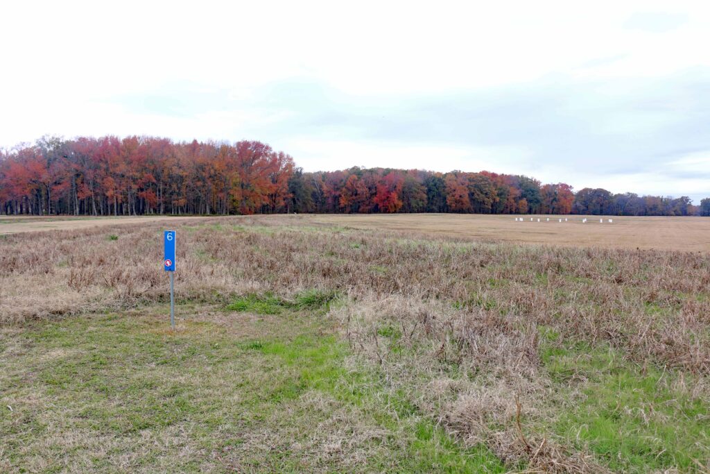
STATION 6 – RIDGE 1 SOUTHWEST
From this vantage point on the southern end of the site, you can trace the path of the innermost ridge (Ridge 1) of the C-shaped earthworks as it curves to the north and then to the east, ending at Bayou Magon about 1,950 ft (595 m) away. The large and topographically subtle ridges, varying from 0.3 to 6 ft (IO- 185 cm) in height relative to their adjacent swales, are marked by taller grass to help you see them. It is easy to understand why the ridge system wasn’t recognized until archaeologist James Ford examined an aerial photograph of the site.
The American Indians undoubtedly built houses and conducted many activities on the ridges. Excavations indicate that they were used as living areas, based on the presence of cooking pits, hearths, postmolds (soil stains left by rotted posts), midden (dark soils with high organic content and accumulated debris from habitation), and abundant artifacts. The artifacts include large numbers of firedearth “cooking balls” known as Poverty Point Objects (PPOs), along with stone projectile points and knives (and debris created while making them), stone vessel fragments, plummets (tear-drop-shaped weights), blades, and other tools. Radiocarbon dates suggest the ridges were in use from about 1530 BC to 1150 BC.
Laid end-to-end, the combined ridge segments at Poverty Point equal about 6 miles (9.5 km) of living area. If a structure was placed every 50 ft (15 m), over 600 houses could be spaced along the ridges, providing room for a considerable population. The site was probably not fully occupied year-round.
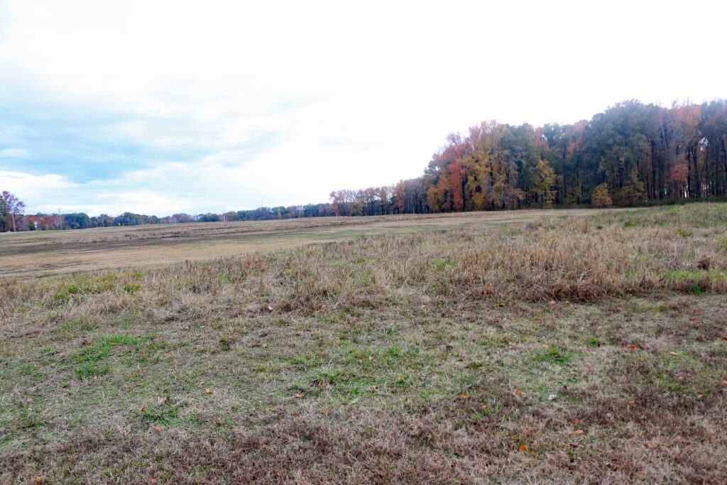
From here, you can also appreciate the impressive size of Poverty Point’s central plaza. nie plaza’s 43 acres (17.4 ha) of open space provided an ideal location for the Poverty Point people to hold social events such as meetings, ceremonies, games, or trade activities. To create this flat, central plaza, the site’s builders used basketloads of soil to fill gullies and raise low areas by as much as 3.3 ft (l m).
Station 6
On way to Station 7
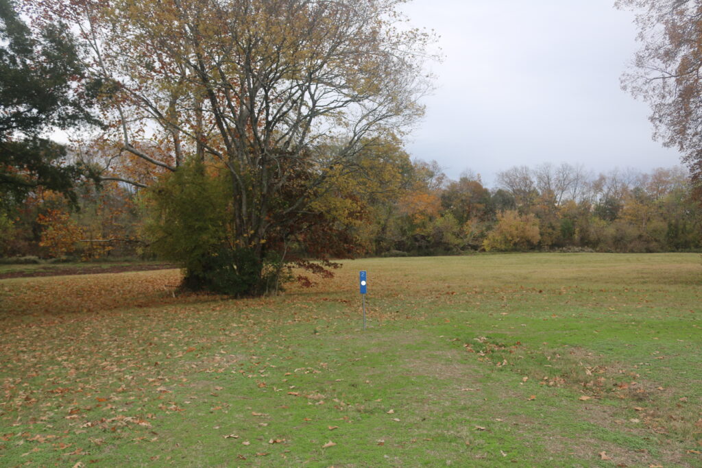
Station 7 – Surveying Monument
This concrete and brass marker is one of five permanent monuments located in various areas of the site. The exact location has been determined for each monument. By using a surveying instrument, archaeologists can compare the placement archaeological excavations or artifacts of Poverty Point to this or another of the monuments and know precisely where they are located. The elevation of this monument is 99.209 ft. (30.239 m) above mean sea level.
Going on to Station 8
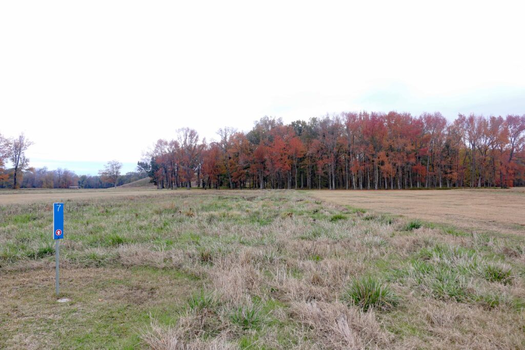
STATION 8 – THE CAUSEWAY
Archaeological excavations and soil cores from this earthwork indicate that it, like the mounds and ridges, is composed of “loaded” earth. This means that the Causeway was built by dumping one basket load of soil after another in this location until an elevated walkway across this low, wet area was completed. The Causeway provided a route out of the site, perhaps leading to small outlying Poverty Point hamlets or camps located to the southwest. The low area that the Causeway traverses may have been a borrow area from which dirt was removed to build some of the earthworks. The Causeway was most likely constructed sometime after 1410 BC.
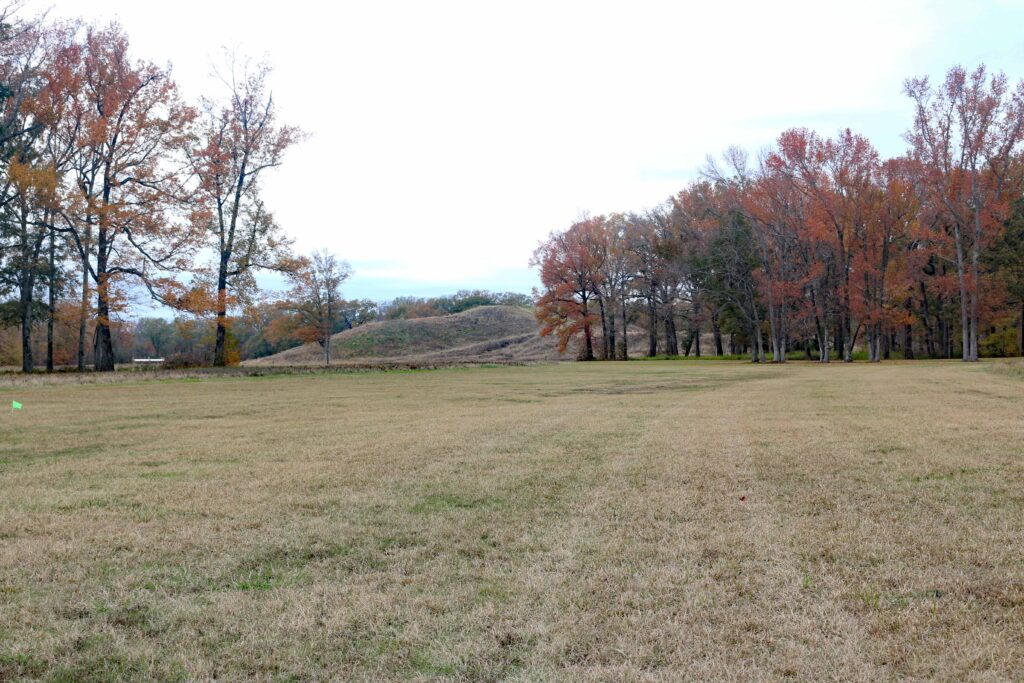
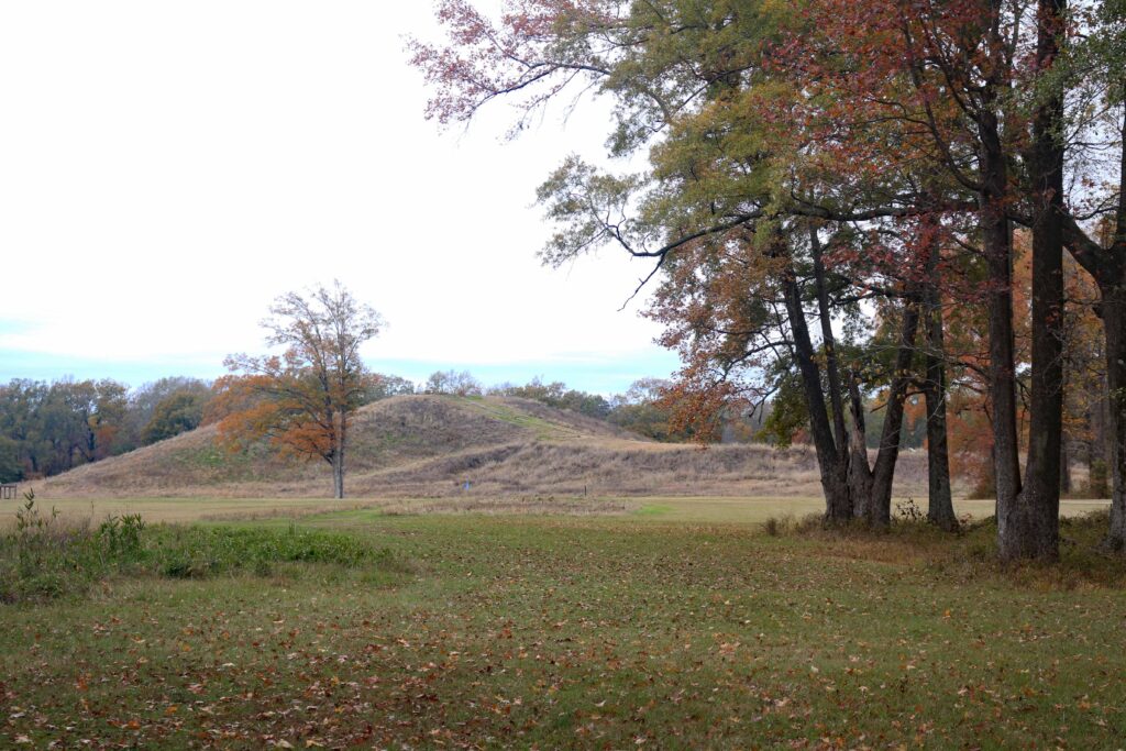
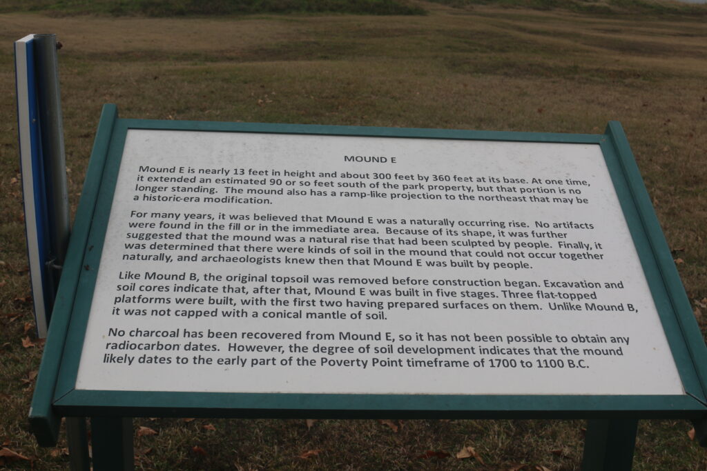
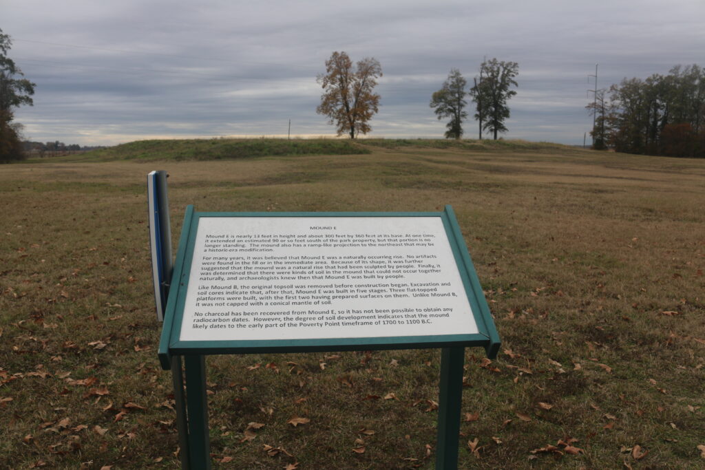
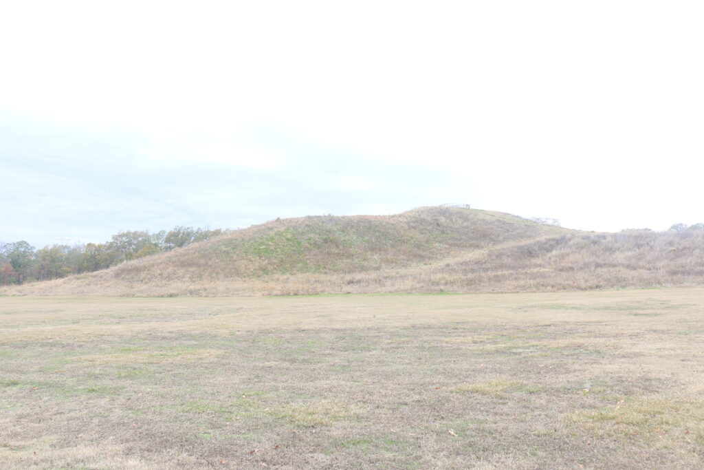
STATION 9 – MOUND E
This flat-topped mound is nearly 13 ft (4 m) in height and 300 by 360 ft (90 x 110 m) at the base. There is a short extension, or ramp, on the northeast corner that appears to continue as a low ridge into the western plaza and perhaps all the way to Mound C. Mound E was built as a series of three flat platforms. The topsoil was scraped from the original ground surface before constructing the first platform. Such a “clean start” was a common practice for mound builders of the Lower Mississippi Valley.
For many years, archaeologists were not certain whether this mound was a natural feature of the landscape or an artificial construction. Finally, in the 1990s, soil cores confirmed that Mound E is an earthwork. Archaeologists recently recovered a tiny piece of wood charcoal from beneath the ramp of Mound E. A radiocarbon date indicates the mound was built sometime after 1500 BC. This is consistent with soil characteristics that indicate this mound was likely constructed in the early part of the Poverty Point culture occupation. The purpose of Mound E is unknown. Archaeologists have found no evidence for houses or other activities on or within the mound.
Feel free to take a rest on the shaded benches at the Contact Station prior to continuing your hike. Proceed northeastward to Station 10, located at the base of Mound A’s platform.
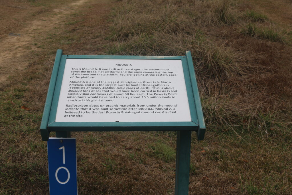
STATION 10 – MOUND A
In the 1950s, archaeologist James Ford suggested that Mound A is shaped like a bird in flight. Ford envisioned the north-south extensions of the cone as the wings and the eastward extending platform as the tail. Today, Mound A is sometimes referred to as the “Bird Effigy Mound.” We do not know if the builders intended it to be a bird, but birds are often represented in the art of Southeastern Indian tribes, including on artifacts from Poverty Point.
Dated to about 1350 BC, Mound A is the largest mound built by American Indians at Poverty Point or at any earlier time in U.S. history. Mound A remained the largest earthen construction in the U.S. for the next 2,000 years. Climb the wooden boardwalk to the top for a panoramic view at Station 11.
MOUND A
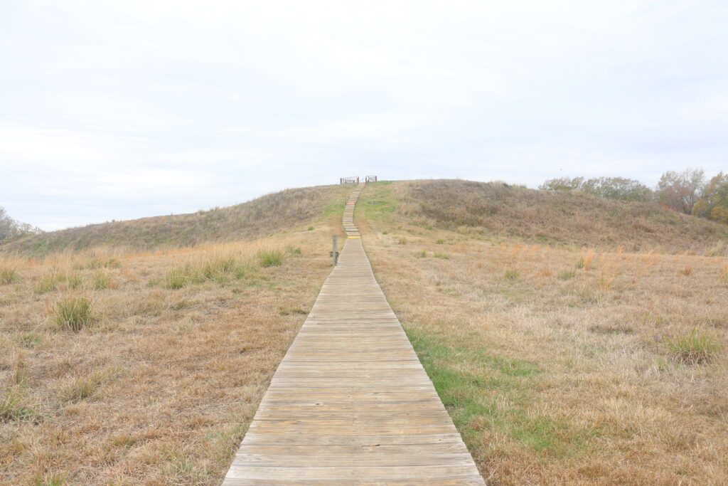
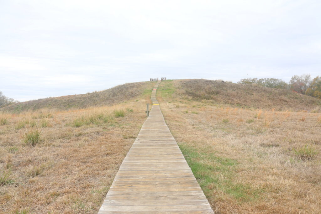

STATION 11 – APEX OF MOUND A
Mound A today is 72 ft (22 m) tall. Its base measures 705 ft (215 m) in length (east to west) and 660 ft (200 m) in width (north to south). This huge monument was built by piling basket loads of earth. It contains about 390,000 tons (8,422,548 cubic ft; 238,500 cubic m) of earth, or about 15.5 million 50-pound (23 kg) basket loads of soil!
Mound A was built in three distinct stages: l) the cone or the tall ridge on the western side; 2) the low, flat platform on the east side; and 3) a ramp to connect the platform and cone. Based on archaeological excavation and core samples, some archaeologists have suggested that Mound A was built quickly, perhaps in as few as 90 days!
From the top, look south toward Mound E. Note the four trees on the south end of that mound. Look between trees #1 and #2 (counting from the left), beyond the highway, back almost to the tree line. You will see a low rise in the field. That is Lower Jackson Mound, a Middle Archaic mound, some 1500-2000 years older than Poverty Point. It aligns with Mounds E, A, and B on a north-south line. Few think this alignment is a coincidence; many believe it is some kind of intentional acknowledgment, a tip of the hat, to the ancestors. Retrace your steps to the base of the mound (back to Station 10) and head northward, along Ridge 6 to Station 12.

Looking west from Apex.
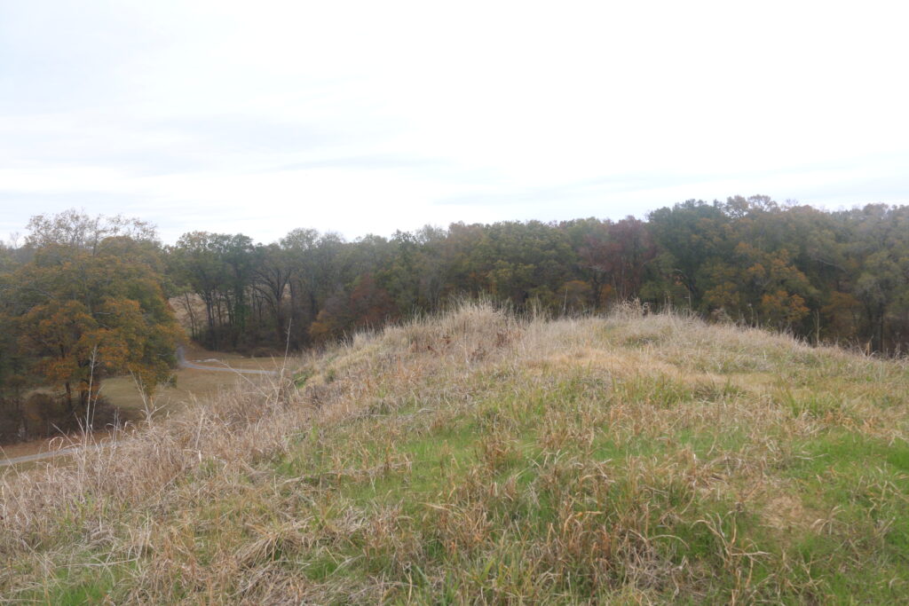
Looking north from Apex.
Looking east from Apex.

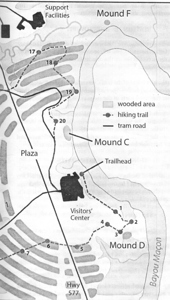
STATION 12 – BORROW PIT
You are standing on Ridge 6 in the western part of the site. Looking to the west (left of the trail), you will see a low depression formed by borrowing dirt to build the earthworks. It is one of several borrow areas at Poverty Point.
Looking to the east (right of the trail), you will see Ridges 5, 4, and 3, and their intervening swales. They are much more obvious here than in the earlier traversed parts of the ridge system. This is probably a result of two factors: 1) the original ground surface was lower here and ridges needed to be built up more to maintain a relative level with ridges elsewhere on the site, and 2) this sector has not been cleared and farmed to the same degree, resulting in less soil erosion from the ridgetops into the swales. Continue on the trail to the open area and look to your left (northwest) for the next directional marker.
Station 12
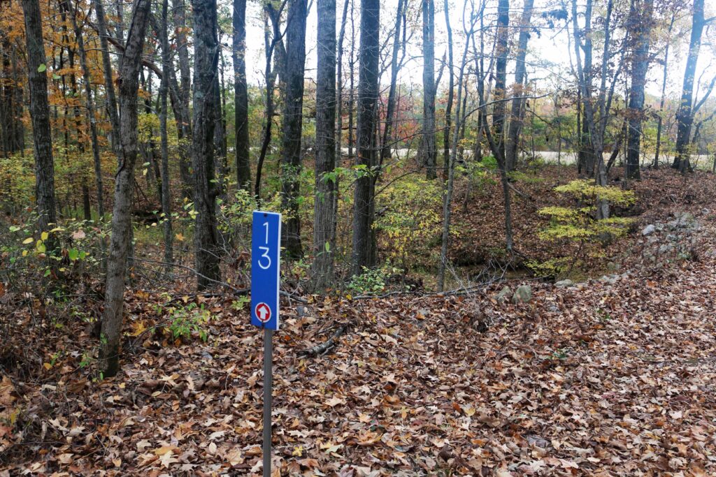
STATION 13 – OLD HARLIN BAYOU
The main channel of Harlin Bayou is now more than 200 yards (183 m) north of this spot, but historic maps indicate that this drainage was the main channel in the late 1840s. This small stream drains the large swamp west of Mound A.

Station 13
Station 13
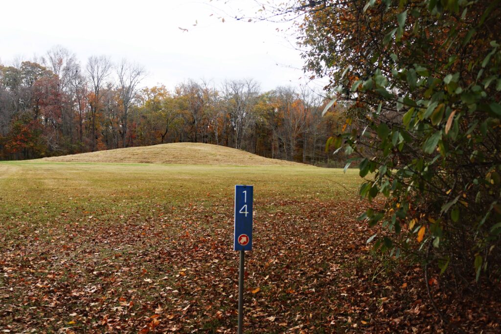
STATION 14 – MOUND B FIELD
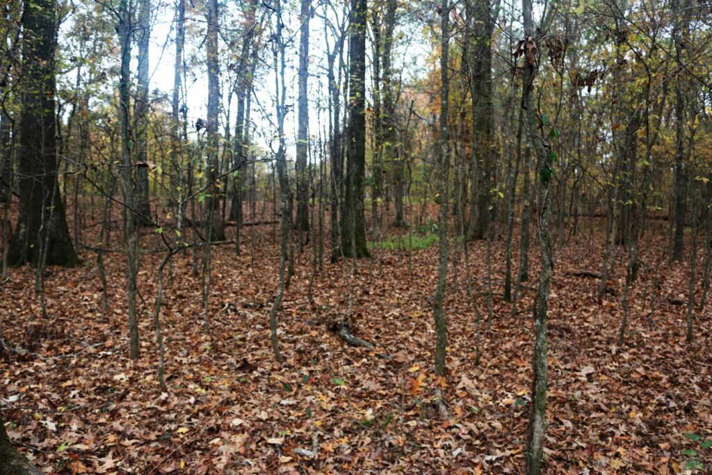
For several thousand years prior to the construction of the Poverty Point earthworks, small groups of hunter-gatherers roamed Macon Ridge. A few spear point types that date to the time before the Poverty Point culture have been found in the large open area to the west (left), which is known as Mound B Field. Thus, this area may have been used longer than other parts of the site.
The Poverty-Point-aged artifacts found in Mound B Field are few in number and represent only part of the entire tool kit. There are no dense middens to indicate extended habitation like found in the ridges. We know the Poverty Point people were active in this area, but we’re not yet sure what they were doing.
Notice how the ground surface on the southern end of the Mound B Field dips down, creating a depression. Soil cores show that up to 6 ft (2 m) of soil in this area was removed, probably to build Mound A or other earthworks.
The logs in the center of the field are part of a fire ring used during evening programs.
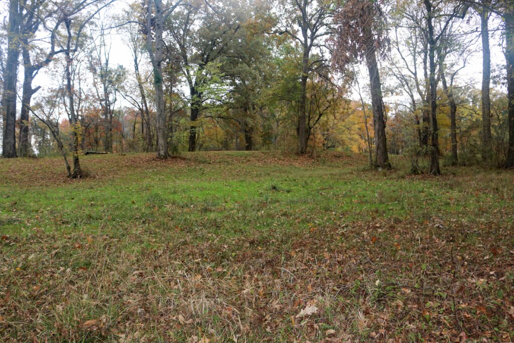
STATION 15 – MOUND B
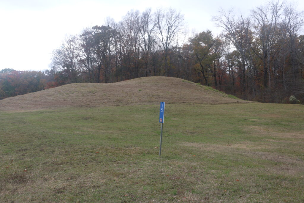
Mound B is the oldest earthwork at Poverty Point, built sometime around 1650 BC. Today, it measures about 21 ft (6.5 m) in height with a basal diameter of 180 ft (55 m). Mound B was originally conical in shape before it was altered by archaeological excavations in 1955.
Like Mound E, the construction of Mound B began by removing the natural topsoil. Thin layers of dark yellowish-brown and gray silt loam were placed on the “clean” surface. Next, three flat-topped platforms were built that reached a height of 14 ft (4 m). The surfaces of these platforms contained fire pits and possible postholes— evidence of activities that took place on the mound. Archaeologists recorded impressions and stains from woven baskets and possible skin containers used to transport the dirt that formed the mound. Its cone shape was formed by soil placed during the final capping event. Follow the trail into the woods.
Station 16

STATION 16 – NATURE WATCH
The people of Poverty Point relied on a range of wild foods from the surrounding landscape. Fish, deer, small mammals, nuts, fruits, and seeds, along with turtles, frogs, waterfowl, and aquatic plants such as lotus and cattail would have been important sources of food. Plants and animals also provided materials used for shelter, cooking, tool production, and warmth.
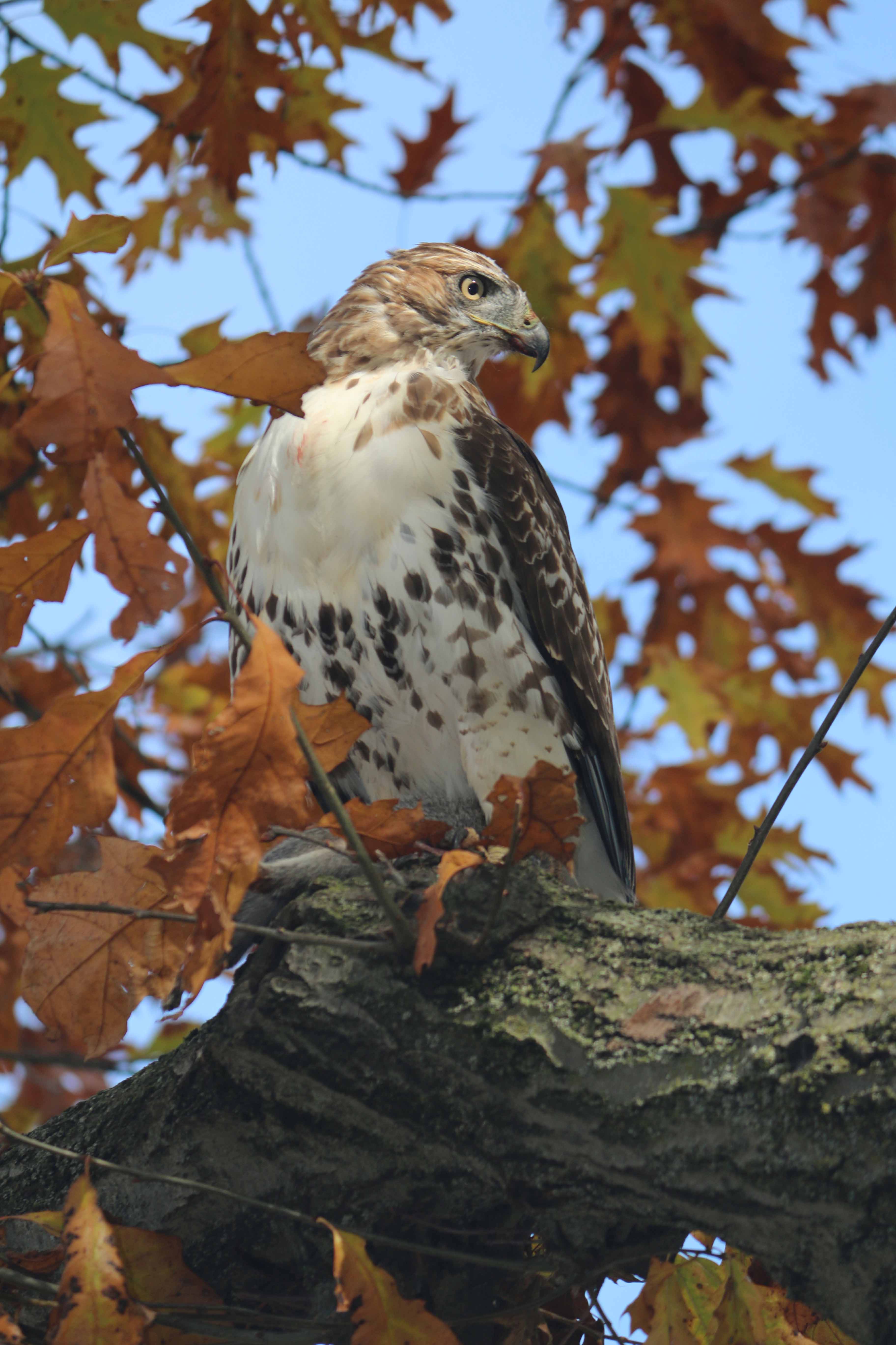
Today, this area is noted for the presence of white-tailed deer, raccoons, squirrels, armadillos (not native to Louisiana), and snakes. Louisiana black bears have also been seen in the area. Depending on the time of year, you can see migratory birds such as indigo buntings, purple martins, bald eagles, or Mississippi kites. Watch for signs of wildlife, such as deer and raccoon tracks.
REMEMBER THAT PLANTS AND ANIMALS, AS WELL AS ARTIFACTS, ARE PROTECTED ON STATE PROPERTY.
Follow the directional posts to the paved tram road and turn left toward the highway. Use caution when crossing the highway. Then, turn left (northeast) off of the tram road, and follow the arrows to the next marker.
Station 16

STATION 17- HARLIN BAYOU
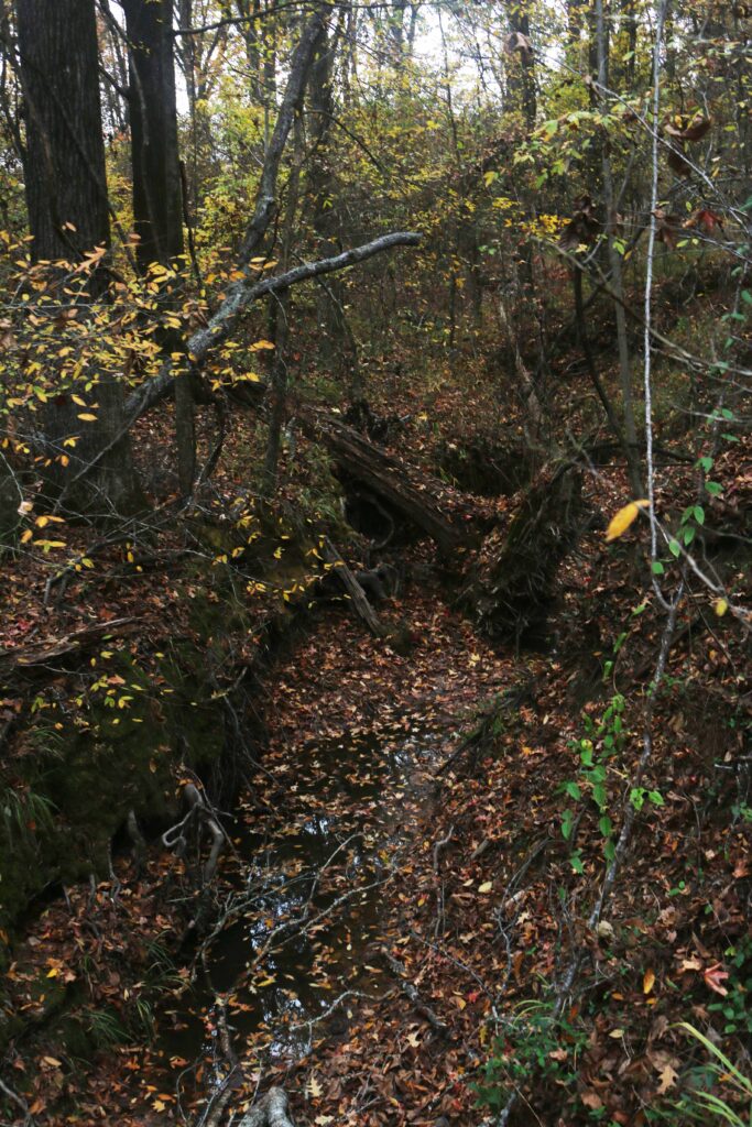
To your left (north), but out of view, is Harlin Bayou. This downward cutting and meandering stream follows a shallow depression that may have begun as a borrow area for soil needed to build the northern ridges or other landscaping projects. Over the past 50 years, the addition of increased water flow from newly cleared farmlands caused Harlin Bayou to cut a wider, deeper channel. The banks were being undercut near where you are now standing, but in 2015 the State of Louisiana funded a stabilization project to halt the damage.
As you continue along the trail, note the understory trees with the large, long leaves. These are pawpaw trees (Asimina triloba) and they are very prolific in this area. These native trees bear edible fruit in the late summer that is soft and sweet, tasting rather like a combination of mango and banana. A variety of animals, including raccoons, foxes, opossums, squirrels, and black bears, like to eat this fruit. Today, the pawpaw (a.k.a. Poor Man’s banana or custard apple) is a trendy food that is used in jams and jellies, a variety of desserts, and even beer.
Station 16/17
Station 16/17
Station 16/17
Station 16/17
Station 16/17

Station 16/17
Station 16/17
Station 16/17
Station 16/17

Station 16/17

Station 16/17
Station 16/17
Station 16/17
Station 16/17

Station 17

Station 17
Station 17
Station 17
Station 17/18
Station 17/18

Station 17/18

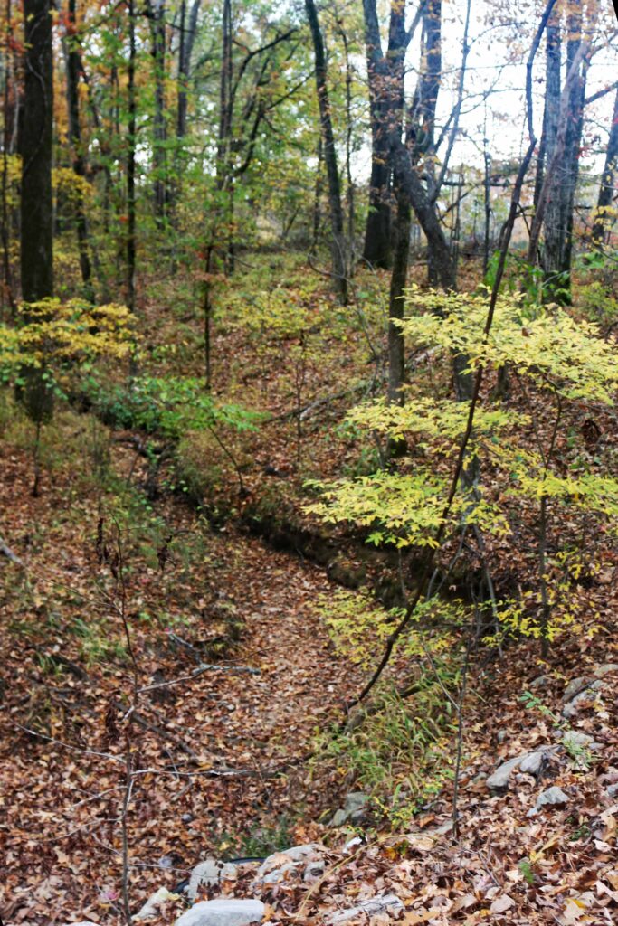
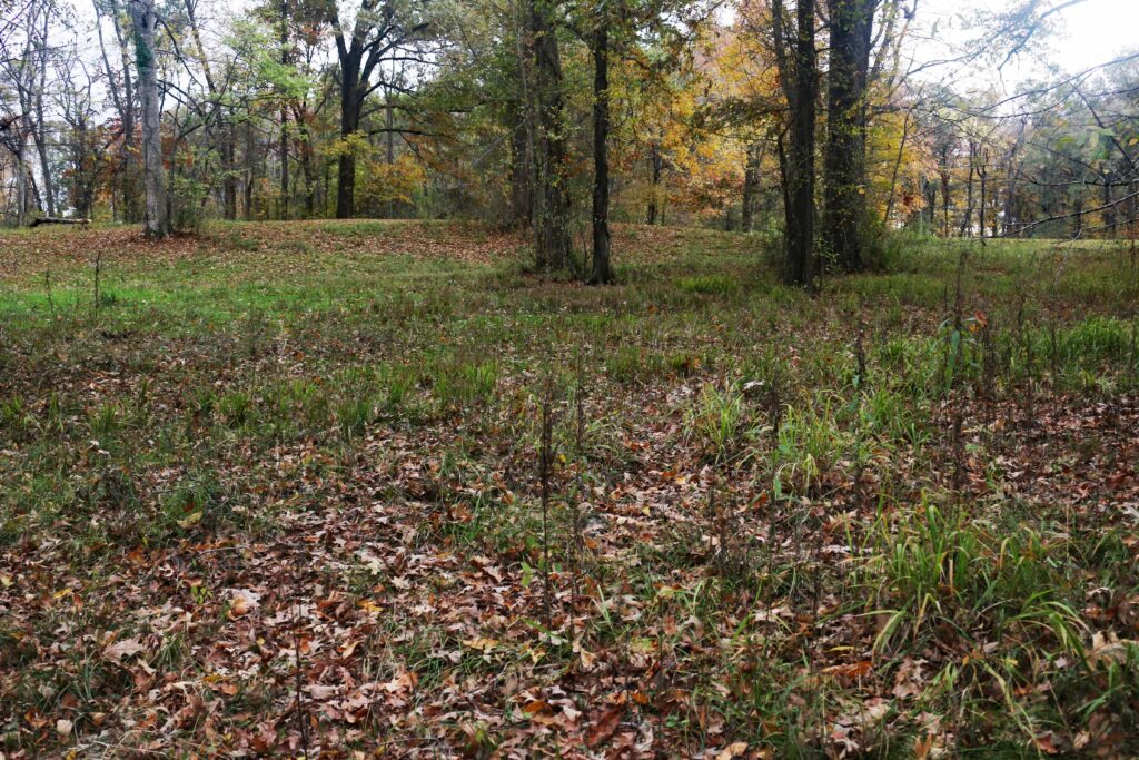
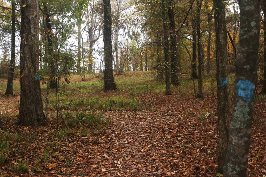
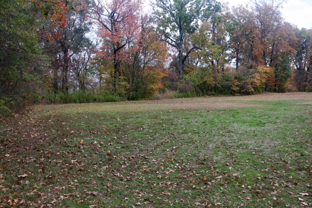
STATION 18 – RIDGE 4 NORTH

Excavations have shown that the Poverty Point people moved a huge amount of earth to build the ridges in this part of the site. There was a large, deep depression in the ground that had to be filled before the Poverty Point people could even begin to build the ridges. Archaeologists documented about 8 ft (2.5 m) of basket-loaded fill dirt beneath Ridges 3 and 4 here. Then, they added more than 6.6 ft (2 m) of earth to build the ridges. Over the years, soil from atop the earthworks has washed down into the swales, so that even here where the earthworks are best preserved, the ridge tops are lower and the swales are shallower than they were originally.

Station 18
Station 19
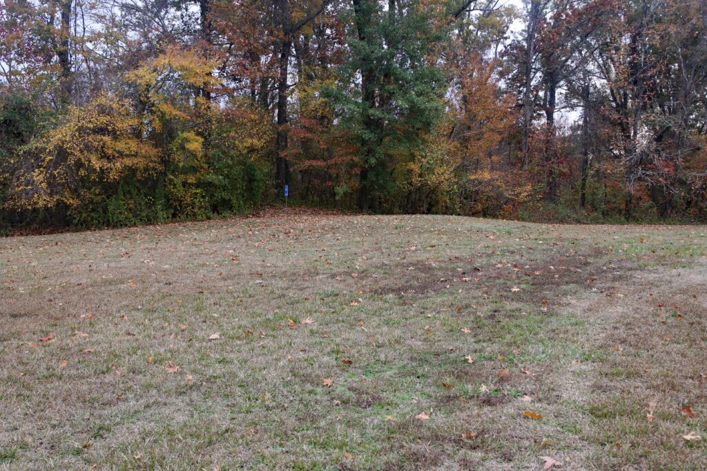
STATION 19 – RIDGE 1 NORTH
East of this spot is a large circular depression containing numerous fragments of brick. No research has been done here so it is not certain what kind of feature this is, but the brick appears to be from an early Euroamerican occupation and is likely locally made. The eastern edge of Macon Ridge is very near this feature. The bayou was cutting into this bank and that action revealed an ancient gully 20 ft (6 m) deep that was filled in by the Poverty Point people as one of their landscaping projects. Follow the paved tram road (south) toward the Visitors’ Center and watch for Station 20 on your left.
Station 19
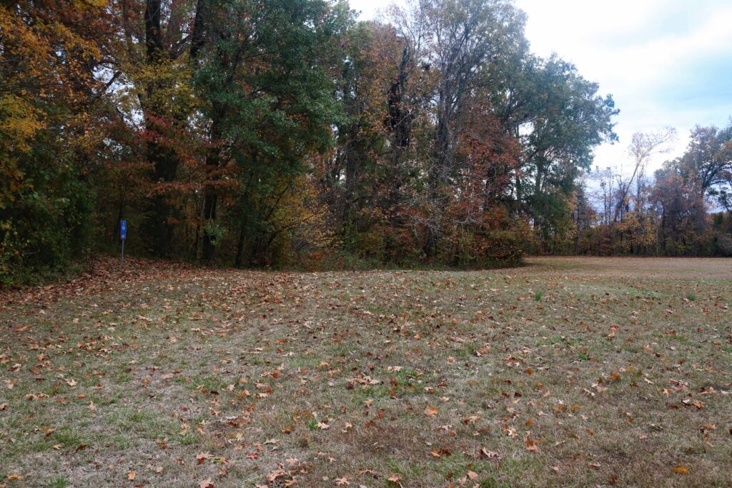
Station 19
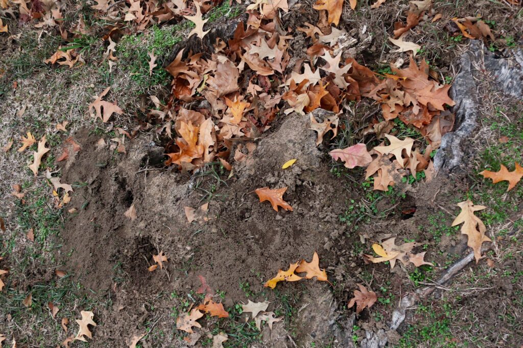
Animal dig near Station 19
STATION 20 – MOUND C
Mound C is today 260 ft (80 m) long by 80 ft (25 m) wide. Part of the mound’s width has eroded into Bayou Magon since its construction. It appears to be 6 ft (1.8 m) in height, but the mound’s actual base is about 2 ft (60 cm) lower than the current adjacent ground surface. The mound wasn’t built in a hole, though. Instead, dirt was added to raise the level of the plaza next to the mound. Mound C may have been originally loaf-shaped, but that form was altered by a historic era road that extended through the mound’s length.
Mound C is unusual in being the only mound located within the Poverty Point plaza. Excavations into the mound revealed up to sixteen thin surfaces or “floors” of differently colored and textured sediments. Some of the surfaces contained artifacts and features such as hearths, pits, and postholes. Like Mound B, the final construction stage of Mound C was the placement of a thick rounded cap of earth over the mound.
Radiocarbon dates from Mound C are consistent with a Poverty Point construction and use. Continue walking south on the tram road to the Visitors’ Center.
CONCLUSION
Numerous earthworks in Louisiana date back to the Middle Archaic period, approximately 2,000 years prior to Poverty Point. However, the Poverty Point complex stands out as the first truly monumental earthen construction north of Mexico. The Poverty Point site also represents the work of a large and organized community with a population that likely numbered, at various times, from a few hundred to a few thousand people. Such a community is remarkable for a hunter-gatherer society. Poverty Point was abandoned around 1100 BC, possibly because of climate change that caused severe flooding in the Lower Mississippi Valley. Flooding could have disrupted the lifeways of the Poverty Point people who depended on the rivers for transportation and on the floodplain environment for much of their food. Following the abandonment of Poverty Point, earthen mounds were not built again in Louisiana until about three hundred years later and, even then, on a much smaller scale. Major mound construction did not take place again in Louisiana until the time of the Marksville culture, during the Middle Woodland period, in the second century AD. However, sites comparable to Poverty Point in both size and complexity were not built again until the Mississippi period, about 2,000 years later.
If you have any questions about the Poverty Point World Heritage Site, or if you would like more information, please stop by the museum and the staff will be happy to assist you.
5. Hike up the south trail of Sandia Mountains, Alburquerque, NM
In Alburquerque, besides Old Town and ballooning there is a mountain to hike. The Forest Service has numerous trails. The trail map is available by searching Sandia Mountain Trails. Use the Forest Service website. The trails are like a spider web on the side of the mountain. The two main trails are the North Trail and the South Trail.
The South Trail has the advantage of crossing the crest. There are three trails to reach the crest. The distance for each is different. On the west side of the mountain is Embudito Trail (192) and Embudo Trail (193). The distance to reach the South Crest Trail (130S) by Embudito is 5.6 miles. By the Embudo Trail is 6.2 miles. There is another trail on the south side of the Mountain. This is the Three Gun Trail. This trail tis 5.5 miles to reach the South Crest Trail. There are more trails on the east side of the mountain. Of course, the crest can be reached by the Sandia Tram and the road that goes up the east side. It is about a 45-minute drive. The trail in 2012 was primitive.
The usual precautions should be made since the writer encountered a bear on his return from the crest. Rather than the smell of pine, there was a heavy musk smell since the bear was upwind. The bear made noise as it walked above the trail. about 60 feet away.
Water and food should be taken. Appropriate clothing should be considered in case the weather changes as rain or a temperature change with
the increase in altitude.
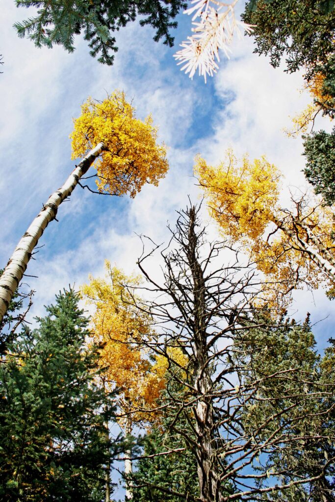
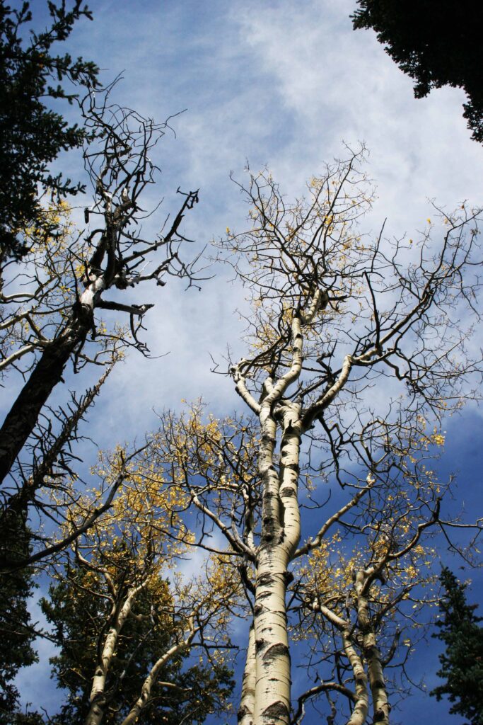
Pictures follow that were taken at the top.
Looking to the southwest from the top. Note that the mountain hides Route 66 just below this spot.

The Rio Grande River is in the background in the green.

Looking down to show how steep it is to go down from this point.

Looking south as the range continues in that direction.
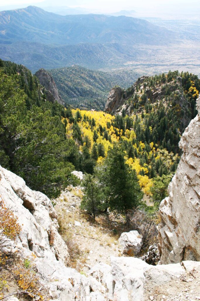
Looking south.
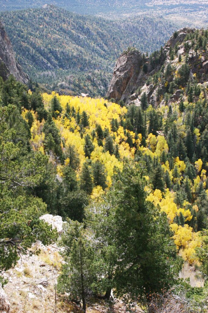

The following pictures were taken on the South Crest Trail.

Val, Your website has some really beautiful pictures!!
Sheila
Shelia,
Thank for the compliment.
The scenery was more spectacular in person.
I have sold framed and unframed pictures.
Val